About the area
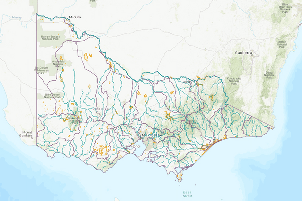
The Hopkins basin is in south-western Victoria. The 2 major rivers within the basin are the Merri River and the Hopkins River.
The basin is predominantly flat terrain, except for low rolling hills in the north that form the headwaters of the Hopkins River and Fiery Creek. The basin is largely cleared and used for agriculture.
Average annual rainfall in the basin ranges from 400-900 mm.
More information on water management and accounting is detailed in Water explained.
2022-23 overview
Available water
Catchment inflow was higher than the previous year.
Licensed diversion restrictions
There were more restrictions on licensed diversions than the previous year.
Water use
More water was diverted for consumptive purposes than the previous year.
When compared to the previous year, in 2022-23:
- more rainfall was received, and catchment inflows were much higher
- there were more restrictions on licensed diversions from unregulated streams
- more water was diverted from the basin for consumptive uses.
Climate
Rainfall
In 2022-23, rainfall across the entire Hopkins basin was very much above the long-term average. This was higher than the previous year when rainfall was close to average.
Figure 1 displays the rainfall received in 2022-23 compared to the long-term average (1975-2023).
Figure 1: Rainfall deciles, Hopkins basin
Sourced from the Australian Bureau of Meteorology
River basin water balance
This section describes the known and estimated inflows, outflows and change of storage volumes in the basin.
Of the total inflows, 98% flowed out into the ocean in 2022-23.
Water balance table
The table below shows the total volumes of water available and supplied from water resources in the Hopkins basin in 2022-23.
Table 1: Water balance, Hopkins basin
Inflows
Catchment inflow
Catchment inflow represents the volume of water flowing into the waterways of a basin. It is calculated as the total outflows and change in storage minus the known inflows.
Large rainfall events across much of the state in October 2022 resulted in high flows, which reduced the ability of gauges to provide accurate streamflow estimates for the Hopkins basin. This impacted the estimates of catchment inflows and end of basin outflow in this basin. Alternative streamflow estimation methods have been required, which have a lower confidence than the method typically used. However, these methods are considered fit for this purpose of basin-scale water accounting.
An explanation of the methods applied can be found in the method tab of Figure 2.
Above average inflows of 944,028 ML were received (290% of the long-term average of 325,100 ML), much more than the previous year (104% of the long-term average).
Above average inflow received
Catchment inflow was 290% of the long-term average of 325,100 ML.
Much more water received than the previous year
This was much more than the previous year (104% of the long-term average).
Wastewater treatment plants
Water treated at wastewater treatment plants can be used to supplement water available in the basin. Water discharged to waterways from treatment plants is included as an inflow to the water balance.
Information on treatment plants is reported in the water supply local reports for the water corporation responsible for managing the plant.
In this basin, wastewater treatment plants are managed by Central Highlands Water, Grampians Wimmera Mallee Water and Wannon Water.
Outflows
Diversions
In 2022-23, 12,063 ML of water was diverted for consumptive uses: town, domestic and stock, irrigation and commercial supply. This is more than the previous year (7,697 ML). While an increase in use was reported, urban and licensed diversions were similar to the previous year. The overall increase in consumptive use was due to the 4,540 ML increase in the estimate of small catchment dam use volume.
Small catchment dams
Water harvested, used, and lost by small catchment dams (farm dams) is included in the water balance.
Table 2: Small catchment dams, Hopkins basin
Entitlements and compliance
Entitlements provide the basis for how water is shared in the basin.
Grampians Wimmera Mallee Water's bulk entitlement to the Hopkins basin (Willaura, Elmhurst and Buangor) is reported in the Wimmera basin, as it covers water sourced from both basins, most of which is sourced from the Wimmera basin.
Entitlement volumes
Rights to water in the Hopkins basin are shown in Table 3.
Entitlement volumes represent a maximum volume of water that can be taken in a one-year period. The volume available in a particular year is dependent on the rules for allocating water set out in the entitlement and the seasonal conditions in that year, which can vary. The rules for allocating water under an entitlement differ between entitlements and systems. This affects the ability and likelihood of water being taken in a particular year.
Table 3: Annual entitlement volumes at 30 June, Hopkins basin
Available water and take under entitlements
Total water available under entitlements represents the volume of water that was available to be taken by entitlement holders in 2022-23. The volume includes seasonal allocations and net trade into the basin.
Water taken
There was 3,946 ML taken under entitlements in 2022-23, more than the previous year (2,944 ML).
Restrictions on licensed diversions from unregulated rivers
- In 2022-23, there were 2 stream section restrictions in place from January-June 2023. The Merri River had a Stage 1 restriction in place from January-April 2023 in Zone A, and from January-June 2023 in Zone B.
- During the previous year, there were no restrictions on licensed diversions.
Available water and take table
This table shows the volume of available water and the volume taken under entitlements in 2022-23.
More information on available water and take has been detailed in How we account for surface
In 2022-23, more water was taken under entitlements than the previous year.
Table 4: Available water and take under entitlements, Hopkins basin
Compliance
Compliance against water entitlements is reported for this basin in 3 areas:
- entitlement issued: that the volume of entitlements issued in a basin does not exceed formal caps, and has not increased without appropriate approvals
- water taken: that the volume of water taken during the year does not exceed the volume considered to be available for consumptive and/or in-stream use during that year
- bulk entitlement provisions: that holders of entitlements do not breach any provisions that are documented in their bulk entitlement orders.
Total entitlement volume
There was no net increase in the total entitlement volume from the previous year.
Total volume diverted
The total volume diverted under entitlements (3,946 ML) was within the volume available for the year (17,963 ML).
Individual bulk entitlements
No individual bulk entitlement holder took more than the annual volume made available to them.
Exceptions to compliance
Individual bulk entitlement holders complied with all provisions in their entitlements.
Water for the environment
Environmental watering sites
There are no environmental entitlements in the Hopkins basin, so no active environmental watering occurs. However, important sites in the Hopkins basin that depend on water for the environment include:
- coastal salt marsh wetlands and the wetlands associated with the Merri River estuary
- the Hopkins River, a major waterway draining the eastern part of the region and entering the Southern Ocean at Warrnambool
- Hopkins estuary, the Merri River and Fiery Creek
- Brucknell Creek and Deep Creek, which provide important fish habitat for species including the Australian grayling and river blackfish
- Mt Emu Creek, which contains reaches with relatively intact remnant riparian vegetation and deep, permanent pools providing drought refuge for threatened species.
Environmental water reserve
In 2022-23, water for the environment in the Hopkins basin comprised:
- water set aside for the environment through the operation of passing flow conditions:
- on consumptive bulk entitlements held by Central Highlands Water
- on licensed diversions, particularly for Cudgee and Mt Emu creeks
- all other water in the basin not allocated for consumptive uses: this water also provides social, recreational and cultural benefits.
Management responsibilities
Management of water in the Hopkins basin is undertaken by various parties
| Authority | Management responsibilities |
|---|---|
| Southern Rural Water |
|
| Wannon Water |
|
| Grampians Wimmera Mallee Water |
|
| Central Highlands Water |
|
| Glenelg Hopkins Catchment Management Authority |
|
| Water supply system | 2021-22 (ML) | 2022-23 (ML) |
|---|---|---|
| Beaufort & Raglan System | 164 | 152 |