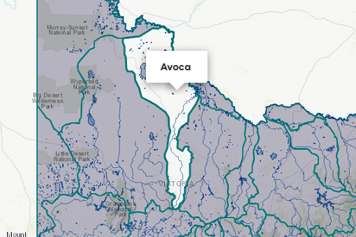
About the area
The Loddon basin is in northern Victoria and includes the Loddon River and a number of smaller connected floodplain channels including Tullaroop, Serpentine, Twelve Mile, Pyramid, Bullock and Bendigo creeks. The basin is crossed by:
- the Waranga Western Channel, which provides water from the Goulburn basin to users in the Loddon Valley Irrigation Area (within the Loddon basin) and
- the Macorna Channel, which provides water from the Murray basin to users in the Torrumbarry Irrigation Area (within the Loddon basin).
The southern part of the basin supplies the Bullarook water shares for irrigators along Birch and Bullarook creeks. For the purposes of these Accounts, the Loddon basin excludes the Torrumbarry Irrigation Area (which is supplied mostly from the Murray River) and the Loddon Valley Irrigation Area (supplied mostly from the Goulburn River).
Annual rainfall is generally low and variable in the basin, decreasing from around 900 mm in the headwaters to below 400 mm in the north.
Mixed grazing of sheep and cattle is common on the steep to undulating land in the basin’s south, with some crop production. Also important in the south are fruit, vegetable and forest industries. Crops are a more important form of land use in the north of the basin where wheat, barley, oats and hay are grown under irrigation. Pig and poultry farming are also significant throughout the basin. Dairy is an important industry in the Torrumbarry Irrigation Area.
More information on water management and accounting is detailed in Water
2022-23 overview
Available water
Catchment inflow was higher than the previous year.
Licensed diversion restrictions
There were fewer restrictions on licensed diversions than the previous year.
Seasonal determinations
Loddon system reached 100% allocation for high and low-reliability water shares - more than the previous year.
Water use
More water was diverted for consumptive purposes than the previous year.
When compared to the previous year, in 2022-23:
- more rainfall was received, catchment inflow was much higher and storage levels peaked and declined at higher levels
- there were fewer restrictions on licensed diversions from unregulated streams
- high-reliability entitlements reached 100% allocation a month earlier
- low-reliability entitlements received an allocation for the first time since the creation of the current entitlement products in 2007
- more water was diverted from the basin for consumptive purposes
- less water was diverted for environmental purposes.
Climate
2022 Flooding
In October 2022, a series of low-pressure systems or surface troughs travelled over south-east Australia, bringing heavy rainfall and storms. The cumulative impact of these on catchments and waterways led to widespread flooding in several basins. Major flooding occurred at several locations along the Loddon River.
Rainfall
In 2022-23, rainfall across the entire Loddon basin was very much above the long-term average. This was much wetter than the previous year when rainfall was average to above average in the basin.
Figure 1 displays the rainfall received in 2022-23 compared to the long-term average (1975-2023).
Figure 1: Rainfall deciles, Loddon basin
Sourced from the Australian Bureau of Meteorology
River basin water balance
This section describes the known and estimated inflows, outflows and change of storage volumes in the basin.
In 2022-23, of the total inflows, 79% flowed out at the end of the basin, either to the Murray River or terminal lakes.
Water balance table
The table below shows the total volumes of water available and supplied from water resources in the Loddon basin in 2022-23.
Table 1: Water balance, Loddon basin
Major on-stream storages
Major - greater than 1,000 ML - on-stream storages in the Loddon basin are included in the water balance. Volumes in off-stream storages are presented for additional information about the resource condition.
Storage levels
Storage levels in the Loddon basin were 96% on 30 June 2023.
Higher than the previous year
On 30 June 2022 storage levels were 57% full.
Table 2: Storage levels, Loddon basin
Inflows
Catchment inflow
Catchment inflow represents the volume of water flowing into the waterways of a basin. It is calculated as the total outflows and change in storage minus the known inflows.
Large rainfall events across much of the state in October 2022 resulted in high flows, which impacted the ability of gauges to provide accurate streamflow estimates for the Loddon basin. This impacted the estimates of catchment inflows, end of basin outflows and losses in this basin. Alternative methods have been required, which have a lower confidence than the method typically used. However, these methods are considered fit for this purpose of basin-scale water accounting.
An explanation of the methods applied can be found in the method tab of Figure 4.
Above average inflows of 938,288 ML were received (385% of the long-term average of 243,400 ML), much more than the previous year (62% of the long-term average). This is reflective of the very much above average rainfall received across the basin.
Above average inflow received
Catchment inflow was 385% of the long-term average annual volume of 243,400 ML.
More water received than the previous year
Catchment inflow was higher than the previous year (62% of the long-term average).
Wastewater treatment plants
Water treated at wastewater treatment plants can be used to supplement water available in the basin. Water discharged to waterways from treatment plants is included as an inflow to the water balance.
Information on treatment plants is reported in the water supply local reports for the water corporation responsible for managing the plant.
In this basin, wastewater treatment plants are managed by Coliban Water, Central Highlands Water, and Lower Murray Water.
Outflows
Diversions
In 2022-23, 56,605 ML of water was diverted for consumptive uses: town, domestic and stock, irrigation and commercial supply. This was more than the 36,790 ML diverted in the previous year. An additional 717 ML of water was diverted for environmental purposes, less than the 1,217 ML diverted in the previous year.
Although there was an increase in the total volume diverted for consumptive use, the volume diverted for irrigation and commercial supply was lower than the previous year and urban use was the same as the previous year. The overall increase in consumptive use was due to the 13,704 ML increase in the modelled small catchment dam use volume and the 9,329 ML increase in the volume of water transferred to the Goulburn (through the Loddon supplement).
Small catchment dams
Water harvested, used and lost by small catchment dams (farm dams) is included in the water balance.
Table 3: Small catchment dams, Loddon basin
Entitlements and compliance
Entitlements provide the basis for how water is shared in the basin.
Entitlements to water in regulated systems in the Loddon basin provide for the right to carry over unused allocation to the next season. In the Loddon regulated system, these entitlement holders can carry over unused water up to 50% of their entitlement volume. Any unused water above this amount is written off.
Consumptive diversions under bulk entitlements are assessed against the Murray-Darling basin annual cap target for the Goulburn-Broken-Loddon Valley. Details of this assessment are published annually in the MDBA’s cap register and annual water take report.
Since 2019-20, the consumptive diversions are also assessed against the annual permitted takes under the Murray-Darling Basin Plan Sustainable Diversion Limit (SDL) compliance reporting which are annually published in the MDBA’s SDL accounts register of take and the Inspector-General of Water Compliance’s SDL compliance statement.
Entitlement volumes
Rights to water in the Loddon basin are shown in Table 4.
Entitlement volumes represent a maximum volume of water that can be taken in a one-year period. The volume available in a particular year is dependent on the rules for allocating water set out in the entitlement and the seasonal conditions in that year, which can vary. The rules for allocating water under an entitlement differ between entitlements and systems. This affects the ability and likelihood of water being taken in a particular year.
Table 4: Annual entitlement volumes at 30 June, Loddon basin
Available water and take under entitlements
Total water available under entitlements represents the volume of water that was available to be taken by entitlement holders in 2022-23. The volume includes carryover from the previous year, seasonal allocations and net trade into the basin.
Water available under entitlements
Low-reliability water shares received an allocation in 2022-23 – the first time since 2007.
Water taken under entitlements
There was 55,817 ML taken under entitlements in 2022-23, more than the previous year (48,741 ML).
Seasonal allocations
Loddon determinations:
- High-reliability entitlement allocations opened at 66% and reached 100% in September 2022 (1 month earlier than the previous year).
- Low-reliability entitlements reached 100% in December 2022. This is the first time low-reliability water shares in the Loddon system have received an allocation since 2007.
Bullarook determinations:
- Both high and low-reliability entitlement allocations reached 100% in August 2022 (one month later than the previous year).
Restrictions on licensed diversions from unregulated rivers
- There were fewer restrictions on licensed diversions from unregulated rivers in 2022-23, with a peak of 19 stream sections banned in March 2023, compared to a peak of 25 in March 2022.
- There were no restrictions on licensed diversions for any stream from July-December 2022.
- There were bans in place for 13 stream sections in January 2023, with an additional 2 bans from February, and an additional 4 bans from March 2023.
Available water and take table
This table shows the volume of available water and the volume taken under entitlements in 2022-23.
More information on available water and take has been detailed in How we account for surface
In 2022-23, more was taken under entitlements compared to the previous year.
Table 5: Available water and take under entitlements, Loddon basin
Compliance
Compliance against water entitlements is reported for this basin in 3 areas:
- entitlement issued: that the volume of entitlements issued in a basin does not exceed formal caps, and has not increased without appropriate approvals
- water taken: that the volume of water taken during the year does not exceed the volume considered to be available for consumptive and/or in-stream use during that year
- bulk entitlement provisions: that holders of entitlements do not breach any provisions that are documented in their bulk entitlement orders.
Total entitlement volume
There was an allowed net increase in the total entitlement volume from the previous year (112 ML). See note below.
Total volume diverted
The total volume diverted under entitlements (55,817 ML) was within the volume available for the year (76,926 ML).
Individual bulk entitlements
No individual bulk entitlement holder took more than the annual volume made available to them.
Exceptions to compliance
Individual bulk entitlement holders complied with all provisions in their entitlements.
Note on entitlement volume increase:
- Water share volume increased by 136 ML (high-reliability) issued for the Irrigator Share Distribution and a 1 ML low-reliability water share was surrendered by a customer.
- There was also a 6 ML decrease in take and use licences that were surrendered by customers.
- A dimension update was made in the Victorian Water Register to update the location of 17 ML of licensed small catchment dam volumes from the Loddon basin to the Campaspe basin.
Water for the environment
Environmental watering sites
Environmental watering sites and environmental values in the Loddon basin that depend on water for the environment include:
- native fish species including golden perch, silver perch, Murray-Darling rainbowfish, river blackfish and Murray cod found in the Loddon River
- Serpentine Creek, which has a population of regionally significant river blackfish, supports small/medium bodied fish and a small population of platypus
- Birchs Creek, which contains native fish, including regionally significant populations of river blackfish and mountain galaxias, as well as flat-headed gudgeon and Australian smelt. Recent monitoring indicates that platypus are present throughout the entire creek
- water from the Loddon basin also flows into the Murray basin, helping to maintain internationally significant Ramsar-listed environmental assets including the Kerang Wetlands and Third Reedy Lake, which support over 150 flora species and over 50 waterbird species including the endangered freckled duck and little bittern.
Environmental water reserve
In 2022-23, water for the environment sourced from the Loddon basin comprised:
- the Bulk Entitlement (Loddon River - Environmental Water Reserve) Order 2005, which includes 3,480 ML of high-reliability, 2,024 ML of low-reliability and 7,490 ML of provisional-reliability entitlements, passing flows which can be flexibly managed, unregulated flows and river-freshening flows
- the Environmental Entitlement (Birch Creek - Bullarook System) 2009, which includes 100 ML of water in Newlyn Reservoir when high-reliability water shares are greater than 20% in the Bullarook system at the start of December
- 3,826 ML of high-reliability water shares and 527 ML of low-reliability water shares held for the environment
- water set aside for the environment through the operation of passing flow conditions:
- on consumptive bulk entitlements held by Central Highlands Water and Goulburn-Murray Water
- on licensed diversions
- all other water in the basin not allocated for consumptive uses: this water also provides social, recreational and cultural benefits.
Environmental water use
A total of 14,351 ML of environmental water was used in the Loddon basin in 2022-23: 3,513 ML of this was diverted off-stream, and the remaining 10,838 ML was delivered in-stream (including accumulated passing flows). 2,796 ML of the diversion was supplied from the Goulburn system to Little Lake Meran and Lake Boort, so it is reported as a diversion from the Goulburn system water balance. Only 717 ML was diverted from the Loddon system.
Management responsibilities
Management of water in the Loddon basin is undertaken by various parties
| Authority | Management responsibilities |
|---|---|
| Goulburn-Murray Water |
|
| Grampians Wimmera Mallee Water |
|
| Central Highlands Water |
|
| Lower Murray Water |
|
| Coliban Water |
|
| North Central Catchment Management Authority |
|
| Water supply system | 2021-22 (ML) | 2022-23 (ML) |
|---|---|---|
| Bridgewater system | 0 | 0 |
| Daylesford & Hepburn Springs System | 646 | 669 |
| Greater Ballarat system | 307 | 344 |
| Laanecoorie system | 132 | 187 |
| Maryborough System | 1,391 | 1,304 |