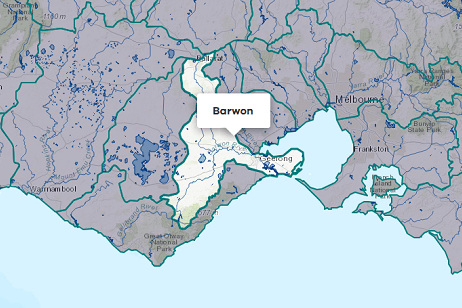
About the area
The Moorabool River begins as 2 major tributaries on the southern slopes of the Great Dividing Range near Ballan and flows south-east to join the Barwon River near Geelong. The Moorabool basin also includes Little River, which flows into Port Phillip Bay.
Flow in the Moorabool River is regulated by releases from Lal Lal Reservoir.
Annual rainfall in the basin decreases from 900 mm in the headwaters to 400-600 mm in the middle and lower reaches.
More information on water management and accounting is detailed in Water
2022-23 overview
Available water
Catchment inflow was higher than the previous year.
Licensed diversion restrictions
There were no restrictions on licensed diversions, the same as the previous year.
Water use
A similar volume of water was diverted for consumptive purposes as the previous year.
When compared to the previous year, in 2022-23:
- more rainfall was received, and storage levels peaked and declined at similar levels
- catchment inflow was much higher, the largest volume received in the last 18 years
- licensed diversion restrictions were the same with no restrictions on licensed diversions from unregulated streams
- a similar volume of water was diverted from the basin for consumptive uses.
Climate
Rainfall
In 2022-23, rainfall across the Moorabool basin was higher than the previous year. Rainfall was very much above the long-term average in the north-west around Moorabool Reservoir to Meredith, and above average around Stony Creek to Port Phillip Bay.
Figure 1 displays the rainfall received in 2022-23 compared to the long-term average (1975-2023).
Figure 1: Rainfall deciles, Moorabool basin
Sourced from the Australian Bureau of Meteorology
River basin water balance
This section describes the known and estimated inflows, outflows and change of storage volumes in the basin.
Of the total inflows, 88% flowed out into the Barwon River (Moorabool River), and Port Phillip Bay (Little River) and other small coastal streams in 2022-23.
Water balance table
The table below shows the total volumes of water available and supplied from water resources in the Moorabool basin in 2022-23.
Table 1: Water balance, Moorabool basin
Major on-stream storages
Major - greater than 1,000 ML - on-stream storages in the Moorabool basin are included in the water balance. Volumes in off-stream storages are presented for additional information about the resource condition.
Storage levels
Major on-stream storage levels in the Moorabool basin were 91% on 30 June 2023.
Similar to the previous year
Storage levels were 85% on 30 June 2022.
Table 2: Storage levels, Moorabool basin
Inflows
Catchment inflow
Catchment inflow represents the volume of water flowing into the waterways of a basin. It is calculated as the total outflows and change in storage minus the known inflows.
Large rainfall events across much of the state in October 2022 resulted in high flows, which impacted the ability of gauges to provide accurate streamflow estimates for the Moorabool basin. This impacted the estimates of catchment inflows, end of basin outflows and losses in this basin. Alternative methods have been required, which have a lower confidence than the method typically used. However, these methods are considered fit for this purpose of basin-scale water accounting.
An explanation of the methods applied can be found in the method tab of Figure 3.
Above average inflows of 322,083 ML were received (311% of the long-term average of 103,400 ML), much more than the previous year (80% of the long-term average). This was reflective of the very much above average rainfall received across the basin in 2022-23.
Above average inflow received
Catchment inflow was 311% of the long-term average of 103,400 ML.
Much more water received than the previous year
Catchment inflow was much more than the previous year (80% of the long-term average).
Wastewater treatment plants
Water treated at wastewater treatment plants can be used to supplement water available in the basin. Water discharged to waterways from treatment plants is included as an inflow to the water balance.
Information on treatment plants is reported in the water supply local reports for the water corporation responsible for managing the plant.
In this basin, wastewater treatment plants are managed by Central Highlands Water and Barwon Water.
Outflows
Diversions
In 2022-23, 22,418 ML of water was diverted for consumptive uses: town, domestic and stock, irrigation and commercial supply. This was similar to the 20,568 ML diverted in the previous year.
Small catchment dams
Water harvested, used and lost by small catchment dams (farm dams) is included in the water balance.
Table 3: Small catchment dams, Moorabool basin
Entitlements and compliance
Entitlements provide the basis for how water is shared in the basin.
The VEWH holds an environmental entitlement in the Moorabool basin, but the water available under the entitlement is used to support streamflows and is not diverted out of the waterway. As this water use is not a diversion from the waterway, it has not been included as part of the water balance diversions in Table 1.
Entitlement volumes
Rights to water in the Moorabool basin are shown in Table 4.
Entitlement volumes represent a maximum volume of water that can be taken in a one-year period. The volume available in a particular year is dependent on the rules for allocating water set out in the entitlement and the seasonal conditions in that year, which can vary. The rules for allocating water under an entitlement differ between entitlements and systems. This affects the ability and likelihood of water being taken in a particular year.
Table 4: Annual entitlement volumes at 30 June, Moorabool basin
Available water and take under entitlements
Total water available under entitlements represents the volume of water that was available to be taken by entitlement holders in 2022-23. The volume includes carryover from the previous year, seasonal allocations and net trade into the basin.
Water taken
There was 20,556 ML taken under entitlements in 2022-23, similar to the previous year (20,663 ML).
Restrictions on licensed diversions from unregulated rivers
There were no restrictions on licensed diversions from unregulated streams in 2022-23, the same as during the previous year.
Available water and take table
This table shows the volume of available water and the volume taken under entitlements in 2022-23.
More information on available water and take has been detailed in How we account for surface
In 2022-23, a similar volume of water was taken under entitlements as the previous year.
Table 5: Available water and take under entitlements, Moorabool basin
Compliance
Compliance against water entitlements is reported for this basin in 3 areas:
- entitlement issued: that the volume of entitlements issued in a basin does not exceed formal caps, and has not increased without appropriate approvals
- water taken: that the volume of water taken during the year does not exceed the volume considered to be available for consumptive and/or in-stream use during that year
- bulk entitlement provisions: that holders of entitlements do not breach any provisions that are documented in their bulk entitlement orders.
Total entitlement volume
There was no net increase in the total entitlement volume from the previous year.
Total volume diverted
The total volume diverted under entitlements (20,556 ML) was within the volume available for the year (57,407 ML).
Individual bulk entitlements
No individual bulk entitlement holder took more than the annual volume made available to them.
Exceptions to compliance
Individual bulk entitlement holders complied with all provisions in their entitlements except one. See note below.
Note on exception to compliance:
- Barwon Water recorded one non-compliance event for passing flow conditions at Bostock Reservoir due to a failed equipment upgrade. This resulted in the failure to pass 0.8 ML/day for a period of 3 days. Once the issue was rectified additional passing flows were released in subsequent days to make up for the reduction in flow.
Water for the environment
Environmental watering sites
Environmental watering sites and environmental values in the Moorabool basin that depend on water for the environment include:
- river blackfish between Lal Lal Reservoir and She Oaks Weir
- the lower Barwon Wetlands, which is part of the Port Phillip Bay and Bellarine Peninsula Ramsar Site
- extensive areas of endangered remnant vegetation including streambank shrubland and riparian woodland ecological vegetation communities
- platypus, water rats and a range of waterbugs.
Environmental water reserve
In 2022-23, water for the environment in the Moorabool basin comprised:
- the Moorabool River Environmental Entitlement 2010, which includes 11.9% of inflows held by the VEWH
- 3,324 ML of treated groundwater discharged from the Fyansford quarry to the lower Moorabool River
- water set aside for the environment through the operation of passing flow conditions:
- on consumptive bulk entitlements held by Central Highlands Water and Barwon Water
- on the VEWH’s Moorabool River Environmental Entitlement 2010
- on licensed diversions
- all other water in the basin not allocated for consumptive uses: this water also provides social, recreational and cultural benefits.
Environmental water use
In 2022-23, a total of 2,500 ML of environmental water was delivered in-stream in the Moorabool basin. Adding to the environmental benefit in the system; 3,324 ML of treated groundwater was discharged from the Fyansford quarry to the lower Moorabool River.
Management responsibilities
Management of water in the Moorabool basin is undertaken by various parties.
| Authority | Management responsibilities |
|---|---|
| Southern Rural Water |
|
| Barwon Water |
|
| Central Highlands Water |
|
| Corangamite Catchment Management Authority |
|
| Melbourne Water |
|
| Water supply system | 2021-22 (ML) | 2022-23 (ML) |
|---|---|---|
| Geelong/Bellarine | 5,994 | 4,263 |
| Greater Ballarat system | 4,665 | 1,867 |