About the area
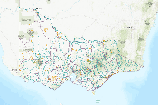
The Wimmera basin covers a large area of western Victoria. The Wimmera River’s headwaters are near Mount Cole in the Pyrenees Ranges. The river flows westwards across the foothills of the Grampians, and at Horsham, it turns north and flows for about 150 km, terminating at Lake Hindmarsh.
Average annual rainfall varies across the basin from up to about 900 mm in the south to 300 mm in the north. While rainfall is variable, winter is typically the wettest season.
Dryland broadacre agriculture is the main industry within the basin, with the production of cereal, oilseed and pulse grains. Dryland livestock production is also significant. A small amount of irrigation occurs for pasture production and there is some horticulture in the basin.
The Wimmera-Mallee Pipeline carries water across the basin for agricultural, environmental and domestic and stock uses.
More information on water management and accounting is detailed in Water explained.
2022-23 overview
Available water
Catchment inflow was higher than the previous year.
Licensed diversion restrictions
There were fewer restrictions on licensed diversions than the previous year.
Seasonal determinations
Allocations for the Wimmera-Mallee Pipeline Product reached a higher level than the previous year.
Water use
A similar volume of water was diverted for consumptive purposes to the previous year.
When compared to the previous year, in 2022-23:
- more rainfall was received, catchment inflow was much higher and storage levels were higher
- there were more restrictions on licensed diversions from unregulated streams
- seasonal allocations were higher, reaching 100% allocation
- a similar volume of water was diverted from the basin for consumptive uses.
Climate
2022 Flooding
In October 2022, a series of low-pressure systems or surface troughs travelled over south-east Australia, bringing heavy rainfall and storms. The cumulative impact of these on catchments and waterways led to widespread flooding in several basins. Major flooding occurred at several locations along the Wimmera River.
Rainfall
In 2022-23, rainfall across the entire Wimmera basin was very much above the long-term average. This was higher than the previous year when rainfall was above average across most of the basin and average in the south.
Figure 1 displays the rainfall received in 2022-23 compared to the long-term average (1975-2023).
Figure 1: Rainfall deciles, Wimmera basin
Sourced from the Australian Bureau of Meteorology
River basin water balance
This section describes the known and estimated inflows, outflows and change of storage volumes in the basin.
Of the total inflows, 62% were outflows to Lake Buloke and Lake Hindmarsh.
Water balance table
The table below shows the total volumes of water available and supplied from water resources in the Wimmera basin in 2022-23.
Table 1: Water balance, Wimmera basin
Major on-stream storages
Major — greater than 1,000 ML — on-stream storages in the Wimmera basin are included in the water balance.
An estimate of rainfall and evaporation for Green Lake in the Wimmera basin has not been made, as data for this site is not available.
Storage levels
Storage levels in the Wimmera basin were 81% on 30 June 2023.
Higher than the previous year
On 30 June 2022 storage levels were 37% full.
Table 2: Storage levels, Wimmera basin
Inflows
Catchment inflow
Catchment inflow represents the volume of water flowing into the waterways of a basin. It is calculated as the total outflows and change in storage minus the known inflows.
Large rainfall events across much of the state in October 2022 resulted in high flows, which impacted the ability of gauges to provide accurate streamflow estimates for the Wimmera basin. This impacted the estimates of catchment inflows, end of basin outflows and losses in this basin. Alternative methods have been required, which have a lower confidence than the method typically used. However, these methods are considered fit for this purpose of basin-scale water accounting.
An explanation of the methods applied can be found in the method tab of Figure 4.
Above average inflows of 505,152 ML were received (226% of the long-term average of 223,100 ML), much higher than the previous year (40% of the long-term average). This is reflective of the very much above average rainfall that was received across the basin.
Above average inflows received
Catchment inflow was 226% of the long-term average annual volume of 223,100 ML.
More water received than the previous year
Catchment inflow was much higher than the previous year (40% of the long-term average in 2020-21).
Wastewater treatment plants
Water treated at wastewater treatment plants can be used to supplement water available in the basin. Water discharged to waterways from treatment plants is included as an inflow to the water balance.
Information on treatment plants is reported in the water supply local reports for the water corporation responsible for managing the plant.
In this basin, wastewater treatment plants are managed by Grampians Wimmera Mallee Water.
Outflows
Diversions
In 2022-23, 21,505 ML of water was diverted for consumptive uses: town, domestic and stock, irrigation and commercial supply. This was similar to the 22,647 ML diverted in the previous year. Although a similar total volume was diverted for consumptive use, the volume diverted for urban and domestic and stock use was 3,817 ML less than the previous year. This was approximately balanced by an increase of 3,935 ML in the estimate of small catchment dam use volume.
An additional 115 ML was delivered to the environment, similar to the previous year (121 ML in 2021-22).
Small catchment dams
Water harvested, used and lost by small catchment dams (farm dams) is included in the water balance.
Table 3: Small catchment dams, Wimmera basin
Entitlements and compliance
Entitlements provide the basis for how water is shared in the basin.
Entitlement volumes
Rights to water in the Wimmera basin are shown in Table 4.
Entitlement volumes represent a maximum volume of water that can be taken in a one-year period. The volume available in a particular year is dependent on the rules for allocating water set out in the entitlement and the seasonal conditions in that year, which can vary. The rules for allocating water under an entitlement differ between entitlements and systems. This affects the ability and likelihood of water being taken in a particular year.
Table 4: Annual entitlement volumes at 30 June, Wimmera basin
Available water and take under entitlements
Total water available under entitlements represents the volume of water that was available to be taken by entitlement holders in 2022-23. The volume includes carryover from the previous year, seasonal allocations and net trade into the basin.
Water available under entitlements
Seasonal allocations reached 100%, higher than the previous year (63% in 2021-22).
Water taken under entitlements
There was 29,959 ML taken under entitlements in 2022-23, less than the previous year (41,035 ML).
Seasonal allocations
Seasonal allocations for the Wimmera-Glenelg system were higher in 2022-23 than in the previous year. The Wimmera Mallee Pipeline Product began the year with a 0% opening seasonal allocation in July 2022, and reached 100% in November 2022. This was more than the previous year which ended at a final allocation of 63% in June 2022.
Restrictions on licensed diversions from unregulated rivers
- There were restrictions on licensed diversions from the Wimmera River from July-August 2022.
- Licensed diversions from the Wimmera River were unrestricted for the whole of 2021-22.
Available water and take table
This table shows the volume of available water and the volume taken under entitlements in 2022-23.
More information on available water and take has been detailed in How we account for surface
In 2022-23, more water was available and less was taken under entitlements compared to the previous year.
Table 5: Available water and take under entitlements, Wimmera basin
Compliance
Compliance against water entitlements is reported for this basin in 3 areas:
- entitlement issued: that the volume of entitlements issued in a basin does not exceed formal caps, and has not increased without appropriate approvals
- water taken: that the volume of water taken during the year does not exceed the volume considered to be available for consumptive and/or in-stream use during that year
- bulk entitlement provisions: that holders of entitlements do not breach any provisions that are documented in their bulk entitlement orders.
Total entitlement volume
There was no net increase in the total entitlement volume from the previous year.
Total volume diverted
The total volume diverted under entitlements (29,959 ML) was within the volume available for the year (245,009 ML).
Individual bulk entitlements
No individual bulk entitlement holder took more than the annual volume made available to them.
Exceptions to compliance
Individual bulk entitlement holders complied with all provisions in their entitlements.
Water for the environment
Environmental watering sites
Environmental watering sites and environmental values in the Wimmera basin that depend on water for the environment include:
- the regionally threatened populations of native fish — river blackfish, southern pygmy perch and mountain galaxias — and platypus (of which there are believed to be less than 10, with this the only population in the catchment) in the MacKenzie River
- the Wimmera bottlebrush (Melaleuca wimmerensis, formerly known as Callistemon wimmerensis) which is listed as threatened under the Flora and Fauna Guarantee Act 1988 (the FFG Act) and as critically endangered under the Environmental Protection and Biodiversity Conservation Act 1999; this species depends on flows in the MacKenzie River for its survival and recruitment
- the lower Wimmera River, which is listed under the Heritage Rivers Act 1992 and which flows into Lake Hindmarsh (listed as a nationally significant wetland) and Lake Albacutya (a Ramsar-listed wetland). It contains Victoria’s only self-sustaining population of freshwater catfish (which is an FFG-Act-listed species). The Wimmera River also contains stocked populations of Murray cod and silver perch, which are both FFG-Act-listed species.
Environmental water reserve
In 2022-23, water for the environment in the Wimmera basin comprised:
- the Wimmera and Glenelg Rivers Environmental Entitlement 2010 held by the VEWH, which includes 40,560 ML of high-reliability entitlement shared with the Glenelg basin, 1,000 ML of entitlement for wetlands supplied from the Wimmera Mallee Pipeline and 1,000 ML of unregulated flow in the Avon-Richardson Rivers to be used to maintain the weir pool at the Rich-Avon Weir
- water set aside for the environment through the operation of passing flow conditions:
- on consumptive bulk entitlements held by Grampians Wimmera Mallee Water
- on licensed diversions
- a supply by agreement with the CEWH under Grampians Wimmera Mallee Water’s bulk entitlement, which includes 28,000 ML of low-reliability entitlement
- all other water in the basin not allocated for consumptive uses: this water also provides social, recreational and cultural benefits.
Environmental water use
A total of 20,491 ML of environmental water was used across the Wimmera, Glenelg and Avoca basins in 2022-23. This volume includes 7,346 ML of passing flows delivered in-stream.
Management responsibilities
Management of water in the Wimmera basin is undertaken by various parties
| Authority | Management responsibilities |
|---|---|
| Grampians Wimmera Mallee Water |
|
| Central Highlands Water |
|
| Coliban Water |
|
| Goulburn-Murray Water |
|
| Wimmera Catchment Management Authority |
|
| North Central Catchment Management Authority |
|
| Water supply system | 2021-22 (ML) | 2022-23 (ML) |
|---|---|---|
| Ararat system | 1,607 | 1,346 |
| Borung | 3 | 3 |
| Buangor | 5 | 16 |
| East Grampians system | 195 | 182 |
| Elmhurst | 25 | 23 |
| Glenthompson system | 28 | 19 |
| Horsham system | 3,044 | 2,724 |
| Korong Vale - Wedderburn | 239 | 91 |
| Stawell | 1,394 | 1,290 |
| Wimmera Mallee Pipeline Supply System 1 | 1,744 | 1,516 |
| Wimmera Mallee Pipeline Supply System 2 | 2,936 | 2,553 |
| Wimmera Mallee Pipeline Supply System 3 | 2,071 | 1,590 |
| Wimmera Mallee Pipeline Supply System 4 | 3,221 | 2,373 |
| Wimmera Mallee Pipeline Supply System 6 | 532 | 412 |
| Wimmera Mallee Pipeline Supply System 7 | 265 | 238 |
| Wychitella | 4 | 2 |