About the area
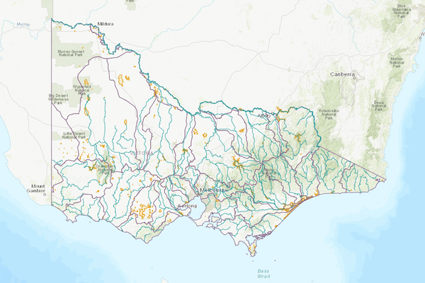
The Glenelg basin is in the far south-west of Victoria. It has 3 on-stream storages, the largest of which is Rocklands Reservoir.
The Glenelg River has the longest estuary in Victoria, with the ocean’s influence extending 75 km upstream from where it flows into the sea at Nelson.
The basin receives 400-900 mm annual rainfall on average, with higher rainfall received in The Grampians ranges in the north-east.
More information on water management and accounting is detailed in Water explained.
2023-24 overview
Available water
Catchment inflow was lower than the previous year.
Licensed diversion restrictions
There were more restrictions on licensed diversions than the previous year.
Water use
Less water was diverted for consumptive use than the previous year.
When compared to the previous year, in 2023-24:
- less rainfall was received, catchment inflow was lower and storage levels were lower
- there were more restrictions on licensed diversions from streams
- less water was diverted from the basin for consumptive uses.
Climate
Rainfall
In 2023-24, rainfall across the entire Glenelg basin much lower than the previous year. Rainfall was:
- lowest on record in most of the basin
- very much below average in the far northern parts of the basin.
Figure 1 displays the rainfall received in 2023-24 compared to the long-term average (1975-2024).
Figure 1: Rainfall deciles, Glenelg basin
Sourced from the Australian Bureau of Meteorology
River basin water balance
This section describes the known and estimated inflows, outflows and change of storage volumes in the basin.
More detail on major on-stream storages, catchment inflows, diversions and small catchment dams can be found in the sections below the water balance.
Of the total inflows, 83% flowed out into the ocean in 2023-24.
Water balance table
The table below shows the total volumes of water available and supplied from water resources in the Glenelg basin in 2023-24.
Table 1: Water balance, Glenelg basin
Major on-stream storages
Major - greater than 1,000 ML - on-stream storages in the Glenelg basin are included in the water balance.
Storage levels
Storage levels in the Glenelg basin were 46% on 30 June 2024.
Lower than the previous year
Storage levels were 60% on 30 June 2023.
Table 2: Storage levels, Glenelg basin
Inflows
Catchment inflow
Catchment inflow represents the volume of water flowing into the waterways of a basin. It is calculated as the total outflows and change in storage minus the known inflows. The long-term average inflow presented has been updated from the previous Victorian Water Accounts, as detailed in Water Explained. The updated long-term average inflow has been applied to this year and the previous year’s volume in this report.
Below average inflows of 270,480 ML were received (52% of the long-term average of 515,300 ML), less than the previous year (195% of the long-term average).
Below average inflow received
Catchment inflow was 52% of the long-term average of 515,300 ML.
Less water received than the previous year
Catchment inflow was lower than the previous year (195% of the long-term average).
Wastewater treatment plants
Water treated at wastewater treatment plants can be used to supplement water available in the basin. Water discharged to waterways from treatment plants is included as an inflow to the water balance.
Information on treatment plants is reported in the water supply local reports for the water corporation responsible for managing the plant.
In this basin, wastewater treatment plants are managed by Wannon Water.
Outflows
Diversions
In 2023-24, 17,619 ML of water was diverted from rivers and streams in the basin, for uses including town, domestic and stock, irrigation and commercial supply. This includes a transfer of 12,858 ML to the Wimmera basin. The volume diverted from the basin is lower than the 40,847 ML diverted in the previous year, largely due to a decrease in the volume transferred to the Wimmera basin. There was also a 6,765 ML decrease in the modelled small catchment dam use volume.
Small catchment dams
Water harvested, used and lost by small catchment dams (farm dams) is included in the water balance.
Table 3: Small catchment dams, Glenelg basin
Entitlements and compliance
Entitlements provide the basis for how water is shared in the basin.
Under Grampians Wimmera Mallee Water’s Wimmera and Glenelg rivers bulk entitlement, the water corporation operates the Wimmera-Glenelg system headworks to supply water to recreational lakes, towns and customers connected to the Wimmera Mallee Pipeline. It includes 3,300 ML for the Glenelg Compensation Flow and 28,000 ML available to the CEWH for use in the Wimmera basin from Wimmera storages. It also supplies entitlements held by Coliban Water, Wannon Water and the Victorian Enviornmental Water Holder (VEWH). The Wimmera and Glenelg Rivers Environmental Entitlement 2010 provides the VEWH with water from the Wimmera-Glenelg system headworks to provide environmental benefits in both the Wimmera and Glenelg basins.
The Wimmera-Glenelg system is unique because the headworks harvest water from both the Glenelg and Wimmera river systems, and the volumes supplied to entitlement holders cannot be separated between the 2 basins. For the purposes of this report, these entitlements are presented in the Wimmera basin.
Entitlement volumes
Rights to water in the Glenelg basin are shown in Table 4.
Entitlement volumes represent a maximum volume of water that can be taken in a one-year period. The volume available in a particular year is dependent on the rules for allocating water set out in the entitlement and the seasonal conditions in that year, which can vary. The rules for allocating water under an entitlement differ between entitlements and systems. This affects the ability and likelihood of water being taken in a particular year.
Table 4: Annual entitlement volumes at 30 June, Glenelg basin
Available water and take under entitlements
Total water available under entitlements represents the volume of water that was available to be taken by entitlement holders in 2023-24. The volume includes seasonal allocations and net trade into the basin.
Water taken
There was 1,345 ML taken under entitlements in 2023-24, less than the previous year (2,959 ML).
Restrictions on licensed diversions from streams
- There was a peak of 2 bans in March 2024. The Crawford River had a ban in place on licensed diversions between November 2023 to June 2024. A short period of restriction was in place for diversions from Wannon River.
- All other streams were unrestricted for the year.
- During the previous year, there was a ban in place on licensed diversions from the Crawford River between January 2023 to March 2023.
Available water and take table
This table shows the volume of available water and the volume taken under entitlements in 2023-24.
More information on available water and take has been detailed in How we account for surface water.
In 2023-24, less water was taken under entitlements than the previous year.
Table 5: Available water and take under entitlements, Glenelg basin
Compliance
Compliance against water entitlements is reported for this basin in 3 areas:
- entitlement issued: that the volume of entitlements issued in a basin does not exceed formal caps, and has not increased without appropriate approvals
- water taken: that the volume of water taken during the year does not exceed the volume considered to be available for consumptive and/or in-stream use during that year
- bulk entitlement provisions: that holders of entitlements do not breach any provisions that are documented in their bulk entitlement orders.
Total entitlement volume
There was no net increase in the total entitlement volume from the previous year.
Total volume diverted
The total volume diverted under entitlements (1,345 ML) was within the volume available for the year (8,603 ML).
Individual bulk entitlements
No individual bulk entitlement holder took more than the annual volume made available to them.
Exceptions to compliance
Individual bulk entitlement holders complied with all provisions in their entitlements.
Water for the environment
Environmental watering sites
Environmental watering sites and environmental values in the Glenelg basin that depend on water for the environment include:
- the lower Glenelg River, which is a heritage river that relies on freshwater inputs from the Glenelg basin to function
- Glenelg spiny crayfish (listed as threatened under the Victorian Flora and Fauna Guarantee Act 1988)
- Yarra and Ewens pygmy perch (listed as vulnerable under the Commonwealth Environmental Protection and Biodiversity Conservation Act 1999 and as threatened under the Flora and Fauna Guarantee Act 1988)
- variegated pygmy perch (listed as vulnerable under the Environmental Protection and Biodiversity Conservation Act 1999 and as threatened under the Flora and Fauna Guarantee Act 1988)
- the Wimmera bottlebrush (Melaleuca wimmerensis, formerly known as Callistemon wimmerensis), which has been recorded on the Glenelg River. This species is very dependent on flows and is listed as critically endangered under the Commonwealth Environmental Protection and Biodiversity Act 1999 and as threatened under the Flora and Fauna Guarantee Act 1988.
Environmental water reserve
In 2023-24, water for the environment in the Glenelg basin comprised:
- a share of water available under the Wimmera and Glenelg Rivers Environmental Entitlement 2010 which includes 40,560 ML of high-reliability entitlement; water available under this entitlement is shared with the Wimmera basin
- water set aside for the environment through the operation of passing flow conditions:
- on consumptive bulk entitlements held by Grampians Wimmera Mallee Water and Wannon Water
- as part of the environmental entitlement held by the VEWH
- on licensed diversions, particularly from the Crawford, Glenelg, Grange Burn and Wannon rivers
- all other water in the basin not allocated for consumptive uses: this water also provides social, recreational and cultural benefits.
Environmental water use
In 2023-24, a total of 11,059 ML of environmental water was used in the Glenelg basin (including 3,725 ML of managed passing flows). This was all delivered in-stream for the Glenelg River under the shared Wimmera and Glenelg Rivers Environmental Entitlement 2010.
Management responsibilities
Management of water in the Glenelg basin is undertaken by various parties
| Authority | Management responsibilities |
|---|---|
| Glenelg Hopkins Catchment Management Authority |
|
| Grampians Wimmera Mallee Water |
|
| Southern Rural Water |
|
| Wannon Water |
|
| Water supply system | 2022-23 (ML) | 2023-24 (ML) |
|---|---|---|
| Konongwootong | 77 | 104 |
| Glenthompson system | 47 | 18 |
| Grampians system | 1,832 | 880 |