About the area
The major rivers of the South Gippsland basin are broadly south-flowing and include the Bass, Powlett, Tarwin, Franklin, Agnes, Albert and Tarra rivers. All of these rivers are unregulated, although the Tarwin and Powlett catchments have on-stream storages for domestic water supply.
The basin’s rivers flow from the Strzelecki and Hedley ranges through productive agricultural land as well as areas of high conservation value, including Wilsons Promontory and Tarra Bulga National Park.
Mean annual rainfall ranges from below 600 mm in the east of the basin to above 900 mm across most of the basin.
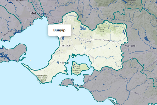
The desalination plant near Wonthaggi produces desalinated water that is transferred into Cardinia Reservoir. The accounting for this is included in the Yarra Basin.
More information on water management and accounting is detailed in Water explained.
2023-24 overview
Available water
Catchment inflow was lower than the previous year.
Licensed diversion restrictions
There was a similar level of restrictions on licensed diversions to the previous year.
Water use
Less water was diverted for consumptive purposes than the previous year.
When compared to the previous year, in 2023-24:
- less rainfall was received, catchment inflows were lower and storage levels peaked and declined at lower levels
- there was a similar level of restrictions on licensed diversions from streams
- less water was diverted from the basin for consumptive uses.
Climate
Rainfall
In 2023-24, rainfall in the South Gippsland basin was lower than the previous year. Rainfall was:
- above average in the far north-east
- below to very much below average in the west and over Wilsons Promontory
- average across the rest of the basin.
Figure 1 displays the rainfall received in 2023-24 compared to the long-term average (1975-2024).
Figure 1: Rainfall deciles, South Gippsland basin
Sourced from the Australian Bureau of Meteorology
River basin water balance
This section describes the known and estimated inflows, outflows and change of storage volumes in the basin.
More detail on major on-stream storages, catchment inflows, diversions and small catchment dams can be found in the sections below the water balance.
Of the total inflows in 2023-24, 97% flowed through and out into Bass Strait and Western Port.
Water balance table
The table below shows the total volumes of water available and supplied from water resources in the South Gippsland basin in 2023-24.
Table 1: Water balance, South Gippsland basin
Major on-stream storages
Major - greater than 1,000 ML - on-stream storages in the South Gippsland basin are included in the water balance.
Storage levels
Storage levels were 65% on 30 June 2024.
Lower than the previous year
Storage levels were 100% on 30 June 2023.
Table 2: Storage levels, South Gippsland basin
Inflows
Catchment inflow
Catchment inflow represents the volume of water flowing into the waterways of a basin. It is calculated as the total outflows and change in storage minus the known inflows. The long-term average inflow presented has been updated from the previous Victorian Water Accounts, as detailed in Water Explained. The updated long-term average inflow has been applied to this year and the previous year’s volume in this report.
Above average inflows of 1,209,112 ML were received (125% of the long-term average of 966,000 ML), less than the previous year (169% of the long-term average).
Above average inflow
Catchment inflow was 125% of the long-term average of 966,000 ML.
Less water received than last year
Catchment inflow was lower than the previous year (169% of the long-term average).
Wastewater treatment plants
Water treated at wastewater treatment plants can be used to supplement water available in the basin. Water discharged to waterways from treatment plants is included as an inflow to the water balance.
Information on treatment plants is reported in the water supply local reports for the water corporation responsible for managing the plant.
In this basin, wastewater treatment plants are managed by Gippsland Water, South Gippsland Water and Westernport Water.
Outflow
Diversions
In 2023-24, 25,971 ML of water was diverted for consumptive uses: town, domestic and stock, irrigation and commercial supply. This was less than the 29,155 ML diverted in the previous year, due to the decrease in the estimate of small catchment dam use volume.
Small catchment dams
Water harvested, used and lost by small catchment dams (farm dams) is included in the water balance.
Table 3: Small catchment dams, South Gippsland basin
Entitlements and compliance
Entitlements provide the basis for how water is shared in the basin.
Entitlement volumes
Rights to water in the South Gippsland basin are shown in Table 4.
Entitlement volumes represent a maximum volume of water that can be taken in a one-year period. The volume available in a particular year is dependent on the rules for allocating water set out in the entitlement and the seasonal conditions in that year, which can vary. The rules for allocating water under an entitlement differ between entitlements and systems. This affects the ability and likelihood of water being taken in a particular year.
Table 4: Annual entitlement volumes at 30 June, South Gippsland basin
Available water and take under entitlements
Total water available under entitlements represents the volume of water that was available to be taken by entitlement holders in 2023-24. The volume includes seasonal allocations and net trade into the basin.
Water taken
There was 15,301 ML taken under entitlements in 2023-24, similar to the previous year (15,979 ML).
Restrictions on licensed diversions from streams
- There were restrictions in place for Greigs Creek from August to September 2023 and a ban in place for Bruthen Creek during May 2024.
- All other streams were unrestricted during 2023-24.
- The previous year saw similar restrictions with 2 streams restricted or banned during 2022-23.
Available water and take table
This table shows the volume of available water and the volume taken under entitlements in 2023-24.
More information on available water and take has been detailed in How we account for surface water.
In 2023-24, a similar volume of water was taken under entitlements as the previous year.
Table 5: Available water and take under entitlements, South Gippsland basin
Compliance
Compliance against water entitlements is reported for this basin in 3 areas:
- entitlement issued: that the volume of entitlements issued in a basin does not exceed formal caps, and has not increased without appropriate approvals
- water taken: that the volume of water taken during the year does not exceed the volume considered to be available for consumptive and/or in-stream use during that year
- bulk entitlement provisions: that holders of entitlements do not breach any provisions that are documented in their bulk entitlement orders.
Total entitlement volume
There was no net increase in the total entitlement volume from the previous year.
Total volume diverted
The total volume diverted under entitlements (15,301 ML) was within the volume available for the year (44,854 ML).
Individual bulk entitlements
No individual bulk entitlement holder took more than the annual volume made available to them.
Exceptions to compliance
Individual bulk entitlement holders complied with all provisions in their entitlements.
Water for the environment
Environmental watering sites
There are no environmental entitlements in the South Gippsland basin, so no active environmental watering occurs.
However, important sites and environmental values in the South Gippsland basin that depend on water for the environment include:
- the Bald Hills Wetland, which is a rehabilitated wetland complex of the once extensive floodplains of the Tarwin River system that supports rare and intact vegetation communities in a largely agricultural environment
- the Bunurong Coast wetlands, which provide habitat connectivity with the marine and estuarine systems
- Corner Inlet and Western Port, which are listed as internationally significant wetlands under the Ramsar Convention and rely on freshwater inputs from the South Gippsland basin to function ecologically
- the Australian grayling population, listed in the Commonwealth Environmental Protection and Biodiversity Conservation Act 1999 and the Victorian Flora and Fauna Guarantee Act 1988, which also relies on water for the environment.
Environmental water reserve
In 2023-24, water for the environment in the South Gippsland basin comprised:
- water set aside for the environment through the operation of passing flow conditions:
- on consumptive bulk entitlements held by Gippsland Water and South Gippsland Water
- on licensed diversions
- all other water in the basin not allocated for consumptive uses: this water also provides social, recreational and cultural benefits.
Management responsibilities
Management of water in the South Gippsland basin is undertaken by various parties
| Authority | Management responsibilities |
|---|---|
| AquaSure (Consortium of Thiess and Suez) |
|
| Gippsland Water |
|
| Melbourne Water |
|
| South Gippsland Water |
|
| Southern Rural Water |
|
| West Gippsland Catchment Management Authority |
|
| Westernport Water |
|
| Water supply system | 2022-23 (ML) | 2023-24 (ML) |
|---|---|---|
| Dumbalk | 17 | 17 |
| Fish Creek | 103 | 105 |
| Foster | 198 | 208 |
| Leongatha system | 1,575 | 1,426 |
| Meeniyan | 46 | 48 |
| Seaspray | 30 | 27 |
| Toora system | 483 | 552 |
| Westernport Water Supply System | 2,096 | 2,368 |
| Wonthaggi system | 2,202 | 2,210 |
| Yarram system | 458 | 420 |