About the area
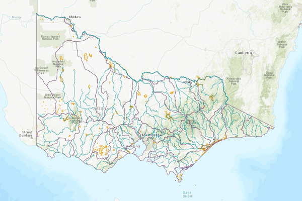
The Murray River forms most of Victoria’s border with New South Wales (NSW). Victoria shares the volume of water held in the major storages with NSW under the Murray-Darling Basin Agreement (MDBA).
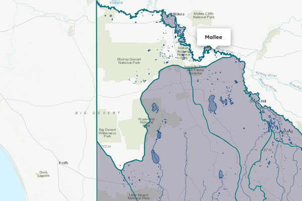
For the purposes of these Accounts, the Murray basin refers to 5 non-contiguous regions, including the Upper Murray basin and 4 smaller areas in Victoria supplied from the Murray River downstream of Lake Hume. The Murray basin also includes flows in the Lower Broken Creek.
There are typically large volumes of water diverted from the Murray River for irrigation and environmental use. Irrigation diversions support significant agricultural production.
More information on water management and accounting is detailed in Water explained.
2024-25 overview
Available water
Catchment inflow was lower than the previous year.
Licensed diversion restrictions
There were more restrictions on licensed diversions than the previous year.
Seasonal determinations
While high-reliability entitlements reached 100% (same as last year), less water was available for low-reliability water shares.
Water use
More water was diverted for consumptive purposes than the previous year.
When compared to the previous year, in 2024-25:
- less rainfall was received, and catchment inflow was lower
- storage levels were lower at the end of the year
- there were more restrictions on licensed diversions from streams
- high-reliability entitlements received 100% allocation, the same as the previous year
- low-reliability entitlements received 0% allocation, less than 100% the previous year
- more water was diverted for consumptive and environmental uses.
Climate
Rainfall
In 2024-25, rainfall received in the Murray basin’s regions varied but was generally lower than the previous year. Rainfall was:
- very much below average around Numurkah
- below average across most of the basin’s regions
- close to average around Swan Hill and near Omeo.
Figure 1 displays the rainfall received in 2024-25 compared to the long-term average (1975-2025).
Figure 1: Rainfall deciles, Murray basin
Sourced from the Australian Bureau of Meteorology
River basin water balance
This section describes the known and estimated inflows, outflows and change of storage volumes in the basin.
More detail on major on-stream storages, catchment inflows, diversions and small catchment dams can be found in the sections below the water balance.
Water balance table
The table below shows the total volumes of water available and supplied from water resources in the Murray basin in 2024-25. This water balance for the River Murray system includes only the Victorian portion of the Murray resource.
The volumes presented in the water balance may not be consistent with the MDBA’s cap compliance reporting due to different accounting methods.
Table 1: Water balance, Murray basin
Major on-stream storages
Major - greater than 1,000 ML - on-stream storages in the Murray basin are included in the water balance. Volumes in off-stream storages are presented for additional information about the resource condition.
Storage levels
Storage levels in the Murray basin were 64% on 30 June 2025.
Lower than the previous year
On 30 June 2024, storage levels were 82% full.
Table 2: Storage levels, Murray basin
Inflows
Catchment inflow
Catchment inflow in the Murray basin is defined as:
- Victoria’s share of inflow to Lake Dartmouth, Lake Hume, Lake Victoria and the Menindee Lakes system
- Victoria’s share of inflow to the Murray from the Kiewa River
- flow from the Ovens, Goulburn, Campaspe and Loddon rivers and from Broken Creek into the Murray River.
Below average inflows of 3,384,649 ML were received (51% of the long-term average of 6,656,200 ML), lower than the previous year (88% of the long-term average).
Below average inflow received
Catchment inflow was 51% of the long-term average annual volume of 6,656,200 ML.
Less water received than the previous year
Catchment inflow was lower than the previous year (88% in 2023-24).
Wastewater treatment plants
Water treated at wastewater treatment plants can be used to supplement water available in the basin. Water discharged to waterways from treatment plants is included as an inflow to the water balance.
Information on treatment plants is reported in the water supply local reports for the water corporation responsible for managing the plant.
In this basin, wastewater treatment plants are managed by Coliban Water, East Gippsland Water, Goulburn Valley Water, Lower Murray Water, and North East Water.
Outflows
Diversions
In 2024-25, 1,610,424 ML of water was diverted for consumptive uses - town, domestic and stock, irrigation and commercial supply - and for diversions to wetlands for environmental purposes. This was more than the 1,459,083 ML diverted during the previous year. A breakdown of these diversions can be viewed by clicking the line item for Urban diversions or Irrigation district diversions in Table 1 above.
Small catchment dams
Water harvested, used and lost by small catchment dams (farm dams) is included in the water balance.
Table 3: Small catchment dams, Murray basin
Entitlements and compliance
Entitlements provide the basis for how water is shared in the basin.
Most entitlements to water in the regulated Murray provide the right to carry over unused allocation to the next season. In the Murray basin, these entitlement holders can carry over unused water up to 100% of their entitlement volume. Water held above entitlement volume is subject to a risk of spill from major storages, although no spills occurred in 2024-25.
Consumptive diversions under bulk entitlements are assessed against the Murray-Darling Basin annual cap target for the Murray-Kiewa-Ovens Valley. Details of this assessment are published annually in the MDBA’s cap register and annual water take report.
Since 2019-20, the consumptive diversions are also assessed against the annual permitted takes under the Murray-Darling Basin Plan Sustainable Diversion Limit (SDL) compliance reporting which are annually published in the MDBA’s SDL accounts register of take and the Inspector-General of Water Compliance’s SDL compliance statement.
Entitlement volumes
Rights to water in the Murray basin are shown in Table 4.
Entitlement volumes represent an indication of a maximum volume of water that can be taken or allocated in any one year depending on the rules of the entitlement. The volume available in a particular year is dependent on the rules for allocating water set out in the entitlement, the seasonal conditions in that year and how much water was carried over from the previous year, which can vary. The rules for allocating water under an entitlement differ between entitlements and systems. This affects the ability and likelihood of water being taken in a particular year.
Table 4: Annual entitlement volumes at 30 June, Murray basin
Available water and take under entitlements
Total water available under entitlements represents the volume of water that was available to be taken by entitlement holders in 2024-25. The volume includes carryover from the previous year, seasonal allocations and net trade into the basin.
Water available under entitlements
While high-reliability entitlements reached 100% (same as last year), less water was available for low-reliability water shares.
Water taken under entitlements
There was 1,690,976 ML taken under entitlements in 2024-25, more than the previous year (1,481,332 ML).
Seasonal allocations
- High-reliability entitlement allocations opened at 63% and reached 100% in November 2024 (later than the previous year).
- Low-reliability entitlements did not receive any allocations 2024-25, returning to zero after 3 years of 100% allocations.
Restrictions on licensed diversions from streams
- There were 6 streams that had bans on licensed diversions from February to June 2025, compared to a peak of 4 bans or restrictions during the previous year.
- All other streams were unrestricted during the year.
Available water and take table
This table shows the volume of available water and the volume taken under entitlements in 2024-25.
More information on available water and take has been detailed in How we account for surface
In 2024-25, more water was taken under entitlements than the previous year.
Table 5: Available water and take under entitlements, Murray basin
Compliance
Compliance against water entitlements is reported for this basin in 3 areas:
- entitlement issued: that the volume of entitlements issued in a basin does not exceed formal caps, and has not increased without appropriate approvals
- water taken: that the volume of water taken during the year does not exceed the volume considered to be available for consumptive and/or in-stream use during that year
- bulk entitlement provisions: that holders of entitlements do not breach any provisions that are documented in their bulk entitlement orders.
Key points on compliance against entitlements in 2024-25
Total entitlement volume
There was no net increase in the total entitlement volume from the previous year.
Total volume diverted
The total volume diverted under entitlements (1,690,976 ML) was within the volume available for the year (2,439,218 ML).
Individual bulk entitlements
No individual bulk entitlement holder took more than the annual volume made available to them.
Exceptions to compliance
Individual bulk entitlement holders complied with all provisions in their entitlements. However, some compliance difficulties were experienced. See notes below.
Notes to exceptions to compliance:
- Goulburn-Murray Water (GMW) reported compliance difficulties with:
- damage to the Woorinen pump station bulk diversion meter requiring an estimate of average efficiency to the annual delivery volume be applied. A project to replace the meter was reported as in progress
- the Nyah pump district being over the annual loss allowance by 774 ML and exceeding the allowed loss headroom by 164 ML. Issues with the Nyah bulk meter were identified and it was being investigated for replacement
- losses in Torrumbarry being 6.3 GL higher than the loss provision in Schedule 1; however, this was within the additional allowed loss and annual headroom allowance loss provision.
- Lower Murray Water (LMW) reported compliance difficulties with the provisions of the:
- Murray irrigation bulk entitlement by exceeding the maximum loss volumes in the Millewa Water Works District by 20.2 ML; however, clause 13 in the bulk entitlement allows the accrual of under/over of losses over a 5-year period. As they exceeded in 2 out of 5 seasons, they expected to be non-compliant in 2025-26. LMW also reported that water taken at the Lake Cullulleraine offtake exceeded the daily rate listed of 120 ML per day in the bulk entitlement due to increased diversions licenced from the lake; however, the volume taken did not exceed the total volume permitted in the bulk entitlement
- Murray urban bulk entitlement by exceeding the nominal volumes listed of water that can be taken at the Mildura/Mildura West and Piangil offtakes, and the Koondrook-Kerang pipeline. Variances in the volume taken are permitted providing the total water allowed under the bulk entitlement is not exceeded.
- The Victorian Environmental Water Holder (VEWH) reported one compliance difficulty for the Murray system, noting that the metering plan for the River Murray - Mitigation Water Environmental Entitlement Order 2023 had not been completed by the 2025 deadline, but it had been developed and had an expected completion in 2025-26.
Water for the environment
Environmental watering sites
Environmental watering sites in the Murray basin that depend on water for the environment include:
- the Barmah-Millewa Forest, Gunbower Forest, Hattah Lakes and Kerang Lakes, which are located along the Murray River and are internationally significant wetlands listed under the Ramsar Convention
- the Living Murray icon sites – which include the Lindsay, Wallpolla and Mulcra islands, the Barmah-Millewa Forest, Gunbower Forest and the Hattah Lakes
- other wetlands in the lower Murray floodplain between Swan Hill and the South Australian border.
Environmental water reserve
In 2024-25, water for the environment in the Murray basin comprised:
- the Bulk Entitlement (River Murray - Flora and Fauna) Conversion Order 1999 - Flora and Fauna component, which includes 45,602 ML of high-reliability, 5,860 ML of low-reliability and 49,000 ML of unregulated entitlements held by the VEWH
- the Bulk Entitlement (River Murray - Flora and Fauna) Conversion Order 1999 - Living Murray, which includes 9,589 ML of high-reliability, 101,850 ML of low-reliability and 34,300 ML of unregulated entitlements held by the VEWH on behalf of the MDBA
- the Bulk Entitlement (River Murray - Flora and Fauna) Conversion Order 1999 - Barmah-Millewa Forest Environmental Water Allocation, a significant operational rule embedded in consumptive entitlements comprising 50,000 ML of high-reliability and 25,000 ML of low- reliability entitlements
- the Bulk Entitlement (River Murray - Flora and Fauna) Conversion Order 1999 - River Murray Increased Flows, comprising Victoria’s share of water recovered under the Snowy Water Initiative released from the Snowy Scheme to the River Murray, held by the VEWH
- River Murray - Mitigation Water Environmental Entitlement 2023, which includes 1,280 ML of high-reliability and 441 ML of low-reliability entitlement, replacing the repealed Environmental Entitlement (River Murray - NVIRP Stage 1) 2012
- the Bulk Entitlement (River Murray - Snowy Environmental Reserve) Conversion Order 2004, comprising 29,794 ML of high-reliability entitlements, held by the VEWH
- 397,674 ML of high-reliability water shares and 44,209 ML of low-reliability water shares held for the environment
- water set aside for minimum flows released by the MDBA as a condition of the Murray-Darling Basin Agreement
- water set aside for the environment through flow-sharing arrangements set out in North East Water’s and East Gippsland Water’s bulk entitlements from unregulated rivers
- all other water in the basin not allocated for consumptive uses: this water also provides social, recreational and cultural benefits.
Environmental water use
A total of 334,813 ML of environmental water was sourced from the Murray basin in 2024-25. Of this, 43,853 ML was diverted off-stream. The remaining 290,961 ML was delivered in-stream in the Murray River.
A total of 544,900 ML of Victorian environmental water crossed the South Australian border. This delivery was supplied from environmental water entitlements in the Murray, Goulburn, Campaspe and Loddon systems.
Management responsibilities
Management of water in the Murray basin is undertaken by various parties.
The Murray-Darling Basin Authority (MDBA) operates the Murray River on behalf of the Victorian, New South Wales and South Australian governments in accordance with the water-sharing arrangements set out in the Murray-Darling Basin Agreement. Under the agreement, Victoria shares the waters of the Murray River with New South Wales and South Australia.
Under normal conditions, Victoria is entitled to a 50% share of all flows upstream of Doctors Point near Albury-Wodonga (that is, flows to Hume and Dartmouth reservoirs and from the Kiewa River), a 50% share of inflows to the Menindee Lakes storage and all flows entering the Murray from the Ovens, Goulburn, Broken, Campaspe and Loddon rivers. Victoria is also required to supply half of South Australia's monthly entitlement flows from the water available to it.
| Authority | Management responsibilities |
|---|---|
| Coliban Water |
|
| Water New South Wales |
|
| Department of Energy, Environment and Climate Action (Victoria) |
|
| East Gippsland Water |
|
| Goulburn Broken Catchment Management Authority |
|
| Goulburn-Murray Water |
|
| Goulburn Valley Water |
|
| Grampians Wimmera Mallee Water |
|
| Lower Murray Water |
|
| Mallee Catchment Management Authority |
|
| Murray-Darling Basin Authority |
|
| North Central Catchment Management Authority |
|
| North East Catchment Management Authority |
|
| North East Water |
|
| South Australian Water Corporation |
|
| Water supply system | 2023-24 (ML) | 2024-25 (ML) |
|---|---|---|
| Barmah | 62 | 54 |
| Bellbridge | 57 | 54 |
| Cobram system | 3,119 | 3,178 |
| Cohuna system | 744 | 716 |
| Corryong system | 239 | 249 |
| Dartmouth | 27 | 31 |
| Echuca | 3,212 | 3,272 |
| Eskdale | 12 | 16 |
| Gunbower | 76 | 77 |
| Katamatite | 82 | 73 |
| Kerang | 997 | 1,169 |
| Koondrook | 244 | 283 |
| Leitchville | 289 | 253 |
| Mildura system | 13,760 | 15,195 |
| Murrabit | 34 | 38 |
| Mystic Park | 11 | 12 |
| Nathalia | 561 | 609 |
| Numurkah system | 973 | 1,118 |
| Omeo | 55 | 62 |
| Piangil | 153 | 156 |
| Picola | 11 | 18 |
| Red Cliffs | 1,277 | 1,287 |
| Robinvale | 605 | 628 |
| Rutherglen/Wahgunyah system | 790 | 734 |
| Swan Hill system | 3,938 | 4,095 |
| Tallangatta | 183 | 234 |
| Walwa | 14 | 17 |
| Wodonga system | 7,956 | 7,947 |
| Yarrawonga system | 1,469 | 1,870 |
| Water supply system | 2023-24 (ML) | 2024-25 (ML) |
|---|---|---|
| First Mildura Irrigation District | 34,257 | 39,375 |
| Merbein Irrigation District | 17,371 | 21,907 |
| Murray Valley Irrigation Area | 283,812 | 319,922 |
| Nyah Irrigation Area | 4,542 | 5,413 |
| Red Cliffs Irrigation District | 33,194 | 38,067 |
| Robinvale Irrigation District | 17,266 | 22,201 |
| Torrumbarry Irrigation Area | 533,592 | 571,055 |