On this page:
The Victorian Water Accounts (VWA) covers all water resource types managed under Victoria’s water entitlement and water resource planning framework.
These are:
- surface water. This is water that occurs or flows on land. It includes water in waterways and in lakes, reservoirs, dams, wetlands and other water bodies. A waterway is a river, creek, stream, watercourse or a natural channel where water regularly flows. This flow does not need to be continuous.
- groundwater. This is any water occurring in an aquifer. An aquifer is any geological formation that contains water (either permanently or intermittently) or allows water to pass through it.
- recycled water. This is water derived from sewerage systems or industrial processes, treated to an appropriate standard for its intended use.
- desalinated water. This is seawater treated to an appropriate standard for its intended use.
Surface water
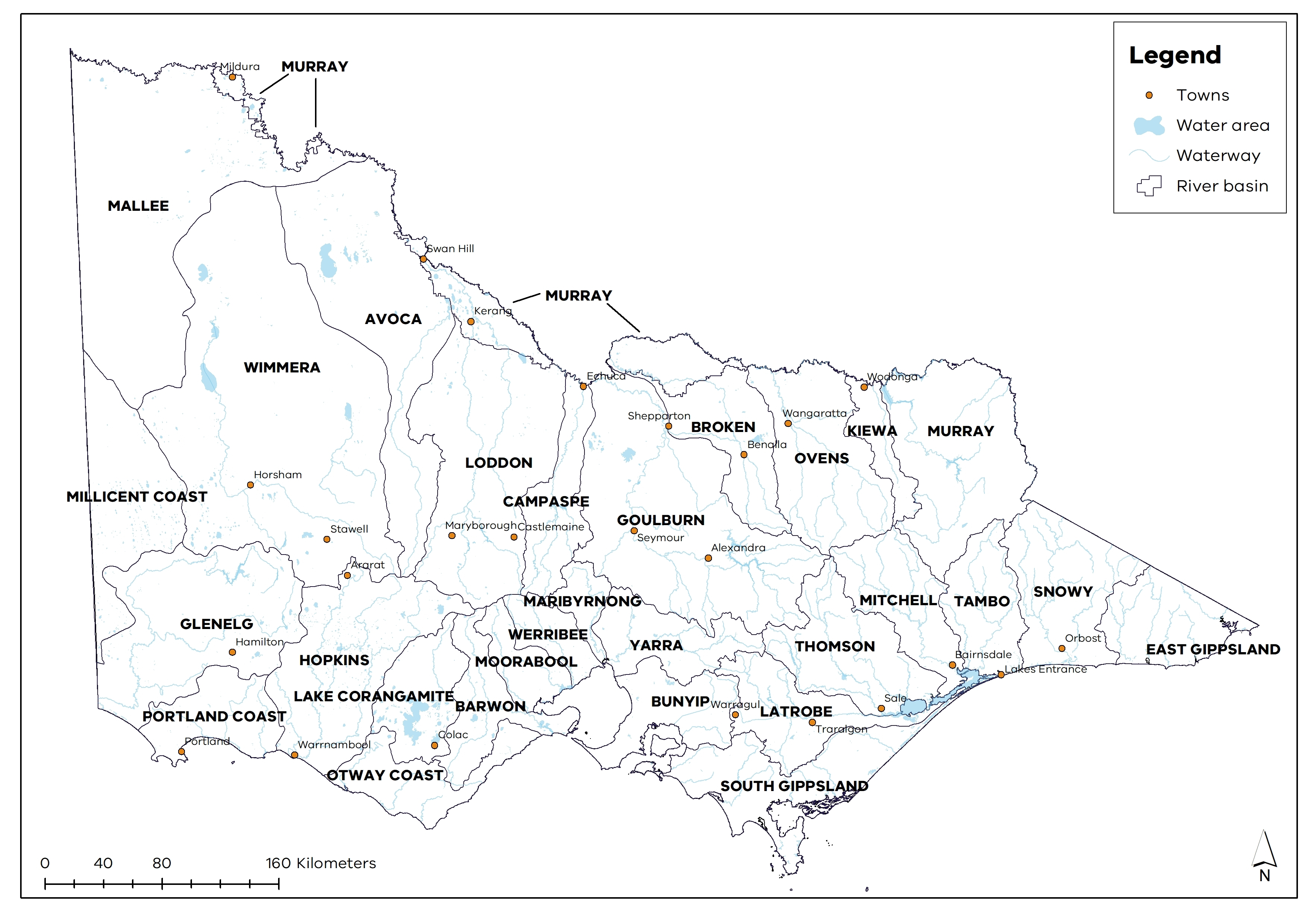
River basins are the primary reporting unit for surface water information for these Accounts (Figure 1). A river basin is the area of land drained by a river and its tributaries. The river basins in the south and east of Victoria drain to the sea, and those in the north drain to the Murray-Darling Basin. Victoria's river basin boundaries are shown in the image below.
We report on availability, use and compliance for the water year for each of the 29 river basins. You can access these via the local surface water reports.
We also report on statewide surface water availability, use, compliance and trade for the water year on the Statewide surface water.
Figure 1: Victorian river basins
Victoria’s waterways can be categorised as either regulated or unregulated systems.
In regulated systems:
- the flow of water in the waterway is regulated and captured through the operation of large dams or weirs
- large volumes of water can be harvested and stored in dams, weirs and other flow-regulating structures, enabling a more reliable supply of water
Most of the state’s regulated water systems have been declared. The allocation of water in declared systems is managed through seasonal determinations and the Minister’s carryover and trading rules.
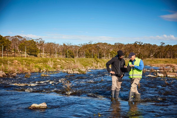
In unregulated systems:
- there are no large dams or weirs controlling the streamflow
- water is taken directly by pumps or diverted to off-stream storages.
- the volume of water available is based purely on rainfall and run-off, not on storage. Therefore, water supplies are more susceptible to variation in streamflow, and less water is available in the drier months and in drought periods. Water resources are managed through rosters and restrictions.
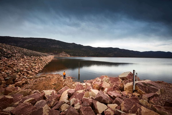
Surface water also includes the water captured and held in small catchment dams. In other jurisdictions, these are sometimes referred to as farm dams, hillside dams or run-off dams. These dams are not located on or fed by a waterway, and they are filled by rainfall and run-off. They intercept flows that may have otherwise flowed into waterways.
Find out more about Victoria's waterways on the DEECA
Groundwater
Groundwater is found beneath the ground's surface in the spaces and fractures in rock and sediment. This comes from rainfall, surface water and snowmelt, which seep from the surface and reach the water table. The water table is an underground boundary between groundwater and the soil surface. Groundwater flows may eventually return to the surface, including as:
- springs
- baseflow into rivers, streams, lakes, wetlands and the ocean.
Groundwater also:
- supports groundwater-dependent ecosystems
- contributes to base flows in streams, which provide environmental value.
Where groundwater is held within an aquifer, it can be pumped to the surface for use.
Rural water corporations are responsible for managing groundwater and reviewing management arrangements to ensure objectives are being met and to respond to changing climate, knowledge, use and legislation.
Further details about the groundwater management in Victoria are available on the DEECA
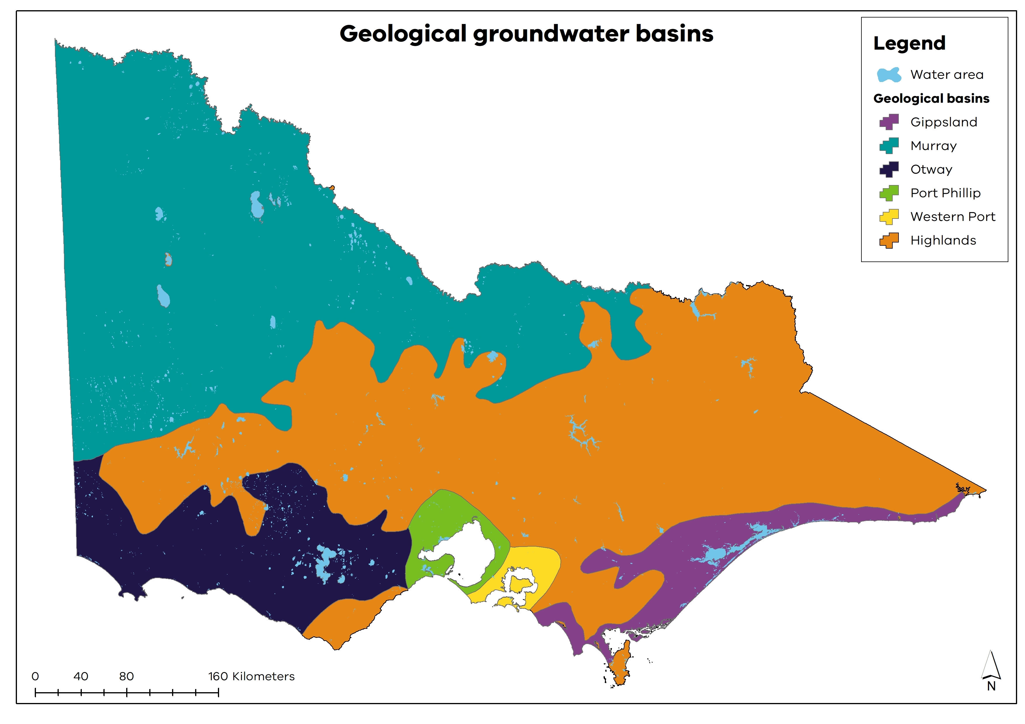
Geological basins contain most of Victoria’s groundwater (Figure 2). Each basin contains layers of sediment, which form Victoria’s aquifers. Further information about Victoria's groundwater resources is available through the DEECA
Figure 2: Victorian geological groundwater basins
Groundwater in the Victorian Water Accounts
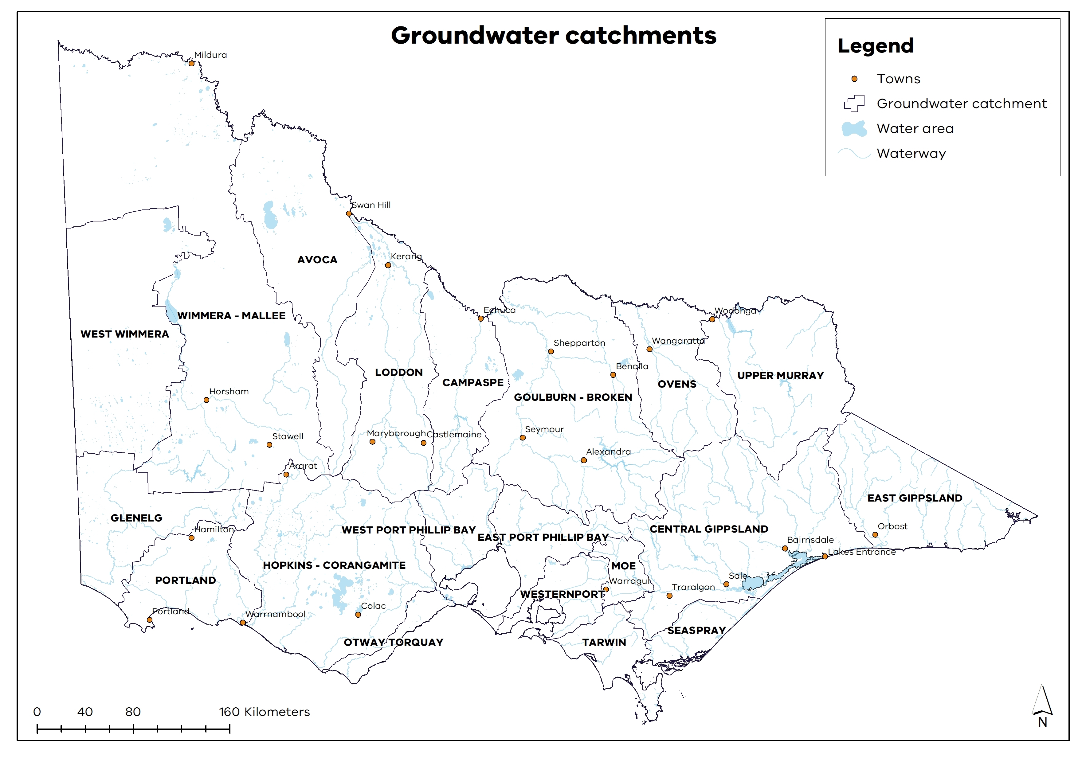
There are 20 groundwater catchments in Victoria (Figure 3). These provide the basis for planning and reporting. The groundwater catchments approximate the surface water basin boundaries, with adjustments based on knowledge and assumptions about groundwater flow divides.
Figure 3: Victorian groundwater catchments
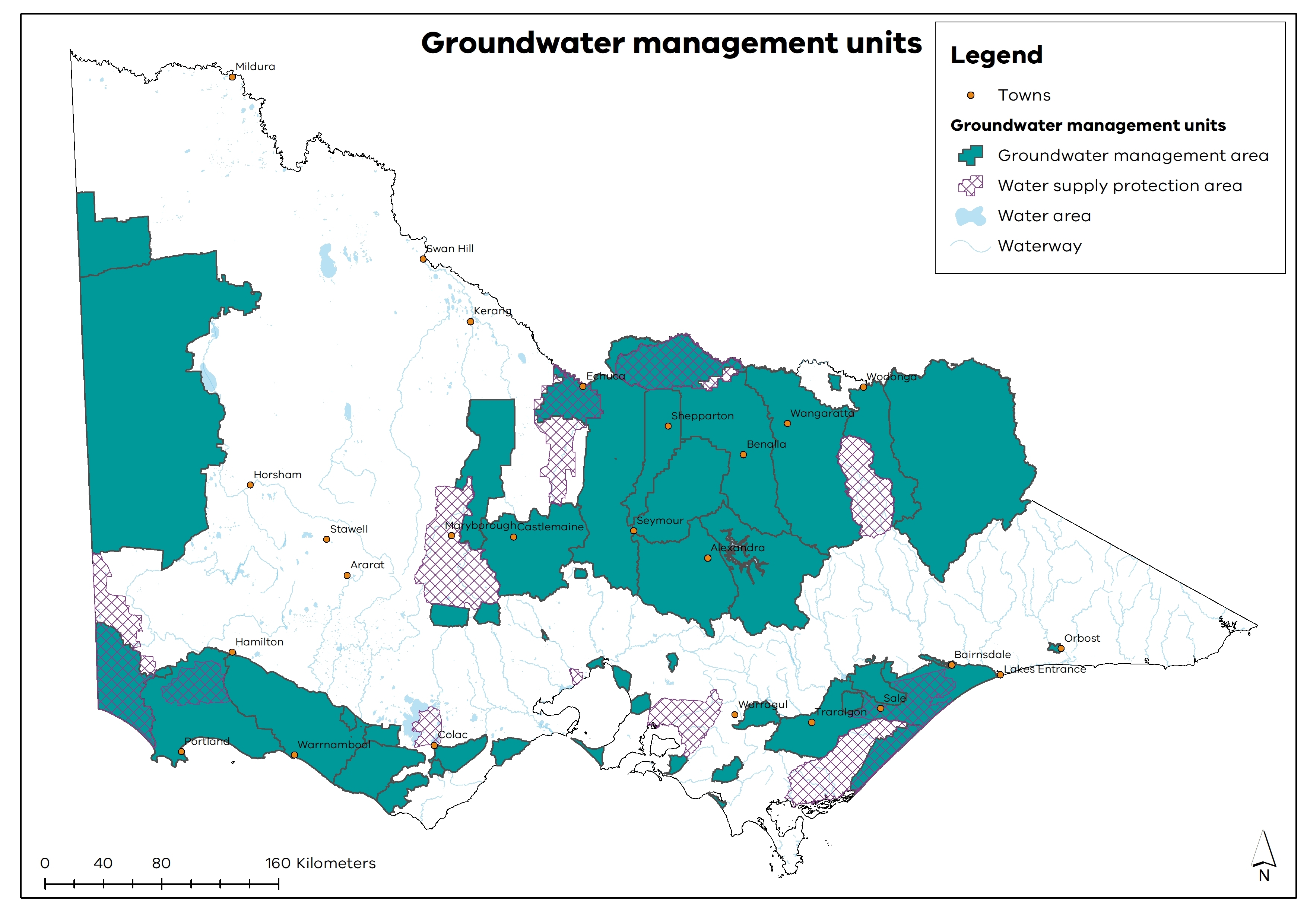
Within groundwater catchments, there are groundwater management units (GMUs) — which are either WSPAs or GMAs (Figure 4).
- Water supply protection areas (WSPAs): areas declared to protect groundwater or surface water resources through the development of statutory management plans.
- Groundwater management areas (GMAs): defined for the purposes of management, most commonly areas where no new groundwater entitlement is available. They may be intensively developed or have the potential to be.
Groundwater resources that are licensed and used outside a WSPA or GMA are reported as outside management units. Generally, a groundwater catchment includes several GMUs where the geographical boundaries of the GMU are contained within and/or aligned with the groundwater catchment boundaries. There are exceptions: for example, a GMU might span several groundwater catchments (such as the West Goulburn GMA, which is in both the Goulburn-Broken and Campaspe groundwater catchments).
Figure 4: Victorian groundwater management units
Each year we report on groundwater availability, use and compliance for the water year on a statewide and local level. These reports include the:
- Statewide groundwater summary - this report details the groundwater available, used and traded across Victoria for the water year.
- Local groundwater reports - these reports detail groundwater availability, use and compliance for the water year for each of the 20 groundwater catchments and 54 groundwater management units in Victoria.
The DEECA has more information on groundwater in Victoria.
Recycled water
Treated wastewater can be recycled for further use. Depending on its level of treatment, this recycled water is suitable for a wide range of non-drinking uses, including agriculture, industry, watering parks and sports grounds, and use in washing machines and toilet flushing. Water corporations deliver this water to customers through a separate (purple) pipe system.
Find out more about diverse water resources on the DEECA
Desalinated water
Desalination is the process of separating salts from seawater to produce fresh water.
The Victorian Desalination Project (VDP) creates high-quality drinking water using reverse-osmosis technology. The VDP is not dependent on rainfall and can supply up to 150 GL of high-quality drinking water a year. This is about one-third of Melbourne’s annual water consumption.
The benefits of the VDP at Wonthaggi are shared with:
- Melbourne’s water network, through a 2-way underground transfer pipeline. These transfers occur through:
- a delivery point at Berwick
- a transfer main to Cardinia Reservoir
- South Gippsland and Western Port, through offtakes along the pipeline. This allows these areas to access the plant or Cardinia Reservoir if required
- beyond Melbourne to Geelong and other regional areas, through the Victorian water grid. This underpins water security for these regions.
The Minister for Water made the first order from the VDP in March 2016.
More information on desalination in Victoria can be found on the DEECA