About the area
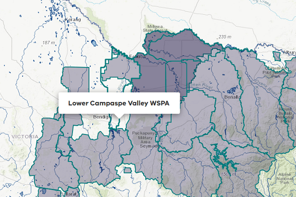
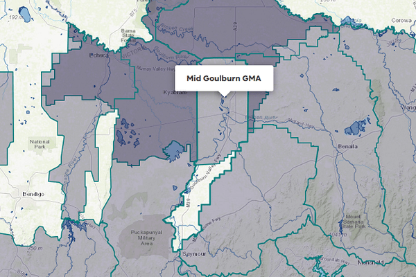
The West Goulburn groundwater management area (GMA) extends from the Great Dividing Range in the south, to the Murray River in the north. The boundary of the GMA ranges between the Goulburn-Broken and Campaspe groundwater catchments that form parts of the Murray-Darling Basin.
Rural centres within the GMA's boundary include Kilmore, Broadford, Rushworth, Kyabram, and Barmah.
The water authority responsible for managing groundwater in the West Goulburn GMA is Goulburn-Murray Water.
The West Goulburn GMA Local Management Plan applies to groundwater up to a depth of 200 m in the area, or 50 m below the base of the Tertiary sediments, whichever is greater.
The north of this GMA is overlain by the Shepparton Irrigation Region (SIR) GMA. At this intersection, the SIR GMA applies to groundwater at a maximum depth of 25 m below the surface, and the West Goulburn GMA covers groundwater at depths greater than 25 m.
This GMA is administered by 4 management zones: Puckapunyal, Kyabram, Cornella, and Corop Lakes.
More information on the GMA can be found on the Goulburn-Murray Water
Groundwater level trends
Table 1: Groundwater level trends, West Goulburn GMA
Response to water availability
Groundwater restrictions
There were no restrictions on licensed use in the West Goulburn GMA in 2024-25.
Entitlements and use
Groundwater is available for licensed (non-urban) supply and for domestic and stock use.
Entitlement volumes
Table 2: Groundwater entitlements at 30 June, West Goulburn GMA
Available water and take
The table below shows the total water available and taken under entitlements, and estimated domestic and stock use in 2024-25. Total water available under entitlements is calculated as the sum of: opening carryover from the prior year (where available), allocation issued during the reporting year, and the net trade in or out of water, across all entitlements. The level of allocation issued is reduced if there are any restrictions in place.
Estimated domestic and stock use is calculated based on an assumed usage per registered bore per year. In this GMA, the assumed usage is 2 ML per bore per year.
More information on groundwater use and availability has been detailed in How we account for
Table 3: Available water and take, West Goulburn GMA
Compliance
Compliance against water entitlements is reported for this groundwater management unit (GMU) in 2 areas:
- entitlement issued: that the volume of entitlements issued in the GMU has not increased without appropriate approvals
- water extracted: that the volume of water taken under entitlements during the year does not exceed the total water available to licence holders.
Key points on compliance against entitlements in 2024-25
There is no permissible consumptive volume (PCV) set for the West Goulburn GMA. However, individual management zone limits have been set in the West Goulburn GMA groundwater management plan. The limits are: 1,000 ML for the Kyabram Zone; 2,500 ML for the Puckapunyal Zone; 500 ML for the Cornella Zone; and 500 ML for the Corop Lakes Zone (a total of 4,500 ML).
Total volume extracted under licences was within the available volume
The total volume extracted under licences (1,422 ML) was within the volume available for the year (3,223 ML).
Table 4: PCV vs total entitlement volume, West Goulburn GMA
Management responsibilities
Management of water in the West Goulburn GMA is undertaken by Goulburn-Murray Water.
| Authority | Management responsibilities |
|---|---|
| Goulburn-Murray Water |
|