About the area
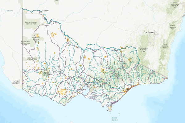
The Goulburn basin covers a large area in northern Victoria. It extends from the Great Dividing Range near Woods Point in the south-east to the Murray River near Echuca in the north-west.
Climate in the basin varies, with the high country experiencing cool winters and persistent snow and regions in the north-west generally experiencing a lower annual rainfall.
Higher stream flows within the basin occur during July-September; lower streamflow occurs during warmer months (January-March).
Agriculture in the basin is diverse, ranging from hardwood timber production in the south-east to dairying and fruit production in the north. Sheep and cropping are important in dryland and irrigated areas.
More information on water management and accounting is detailed in Water explained.
2024-25 overview
Available water
Catchment inflow was lower than the previous year.
Licensed diversion restrictions
There were more restrictions on licensed diversions compared to the previous year.
Seasonal determinations
While high-reliability entitlements received 100% (the same as last year), less water was available for low-reliability water shares.
Water use
More water was diverted for consumptive purposes than the previous year.
When compared to the previous year, in 2024-25:
- less rainfall was received, catchment inflow was lower and storage levels peaked and declined at lower levels
- there were more restrictions on licensed diversions from streams
- high-reliability entitlements reached 100% allocation 2 months later
- low-reliability entitlements received 0% allocation, less than 77% in the previous year
- more water was diverted from the basin for consumptive purposes
- less water was diverted for environmental purposes.
Climate
Rainfall
In 2024-25, rainfall received in the Goulburn basin was lower than the previous year. Compared to the long-term average (1975-2025), rainfall was:
- the lowest on record in the basin’s western regions around Redcastle-Greytown State Forest, Rushworth and Murchison
- very much below average in a band across the centre of the basin from Shepparton towards Healesville and out towards Rochester and Nagambie
- below average in the upper reaches of the Goulburn River and Lake Eildon, Kurkuruk Creek headwaters in the south-west, and where the Goulburn meets the Murray.
Figure 1 displays the rainfall received in 2024-25 compared to the long-term average.
Figure 1: Rainfall deciles, Goulburn basin
Sourced from the Australian Bureau of Meteorology
River basin water balance
This section describes the known and estimated inflows, outflows and change of storage volumes in the basin.
More detail on major on-stream storages, catchment inflows, diversions and small catchment dams can be found in the sections below the water balance.
In 2024-25, of the total inflows, 65% flowed out at the outlets of the Goulburn basin:
- as outflow to the Campaspe River via the Waranga Western Channel
- as outflow to the Murray River
- as outflow to the Murray River via Broken Creek.
Water balance table
The table below shows the total volumes of water available and supplied from water resources in the Goulburn basin in 2024-25.
Table 1: Water balance, Goulburn basin
Major on-stream storages
Major — greater than 1,000 ML — on-stream storages in the Goulburn basin are included in the water balance. Volumes in off-stream storages are presented for additional information about the resource condition.
Storage levels
Storage levels in the Goulburn basin were 58% on 30 June 2025.
Lower than the previous year
On 30 June 2024, storage levels were 89% full.
Table 2: Storage levels, Goulburn basin
Inflows
Catchment inflow
Catchment inflow represents the volume of water flowing into the waterways of a basin. It is calculated as the sum of the total outflows and change in storage minus the known inflows.
Below average inflows of 1,089,697 ML were received (39% of the long-term average of 2,788,200 ML), less than the previous year (93% of the long-term average).
Below average catchment inflow received
Catchment inflow was 39% of the long-term average annual volume of 2,788,200 ML.
Less water received than the previous year
Catchment inflow was lower than the previous year (93% of the long-term average).
Wastewater treatment plants
Water treated at wastewater treatment plants can be used to supplement water available in the basin. Water discharged to waterways from treatment plants is included as an inflow to the water balance.
Information on treatment plants is reported in the water supply local reports for the water corporation responsible for managing the plant.
In this basin, wastewater treatment plants are managed by Goulburn Valley Water.
Outflows
Diversions
In 2024-25, 1,155,397 ML of water was diverted for consumptive uses - town, domestic and stock, irrigation and commercial supply - and the environment. This was more than the 788,264 ML diverted in the previous year. Most of this difference is due to the 361,545 ML increase in the volume diverted for irrigation.
Small catchment dams
Water harvested, used and lost by small catchment dams (farm dams) is included in the water balance.
Table 3: Small catchment dams, Goulburn basin
Entitlements and compliance
Entitlements provide the basis for how water is shared in the basin.
Melbourne Water holds a bulk entitlement to divert surface water from Silver and Wallaby Creeks. This entitlement is one of four which contribute to the Greater Yarra system - Thomson River Pool, which primarily supplies Melbourne and supports regional urban water corporations, including Barwon Water, South Gippsland Water and Westernport Water.
Entitlements (except some waterworks districts entitlements) to water in the regulated system of the Goulburn basin provide for the right to carry over unused allocation to the next season. In the Goulburn basin, holders of these entitlements can carry over unused water up to 100% of their entitlement volume. Water held above entitlement volume is subject to a risk of spill, although no spills occurred in 2024-25.
The Victorian Environmental Water Holder (VEWH) holds Bulk Entitlement (Goulburn System - Snowy Environmental Reserve) Order 2004 and some water shares in trust for the Snowy River. Allocation to the entitlement is traded from the VEWH’s account to the Snowy Scheme so it can be subsequently released from the Snowy Scheme to support the health of the Snowy and Murray rivers. Information about this entitlement can be found in Managed environmental water.
Consumptive diversions under bulk entitlements are assessed against the Murray-Darling Basin annual cap target for the Goulburn-Broken-Loddon valley. Details of this assessment are published annually in the MDBA’s cap register and annual water take report.
Since 2019-20, the consumptive diversions are also assessed against the annual permitted takes under the Murray-Darling Basin Plan Sustainable Diversion Limit (SDL) compliance reporting, which are annually published in the MDBA’s SDL accounts register of take and the Inspector-General of Water Compliance’s SDL compliance statement.
Entitlement volumes
Rights to water in the Goulburn basin are shown in Table 4.
Entitlement volumes represent an indication of a maximum volume of water that can be taken or allocated in any one year depending on the rules of the entitlement . The volume available in a particular year is dependent on the rules for allocating water set out in the entitlement, the seasonal conditions in that year and how much water was carried over from the previous year, which can vary. The rules for allocating water under an entitlement differ between entitlements and systems. This affects the ability and likelihood of water being taken in a particular year.
Table 4: Annual entitlement volumes at 30 June, Goulburn basin
Available water and take under entitlements
Total water available under entitlements represents the volume of water that was available to be taken by entitlement holders in 2024-25. The volume includes carryover from the previous year, seasonal allocations and net trade into the basin.
Water available under entitlements
While high-reliability entitlements received 100% (the same as last year), less water was available for low-reliability water shares.
Water taken under entitlements
There was 1,634,581 ML taken under entitlements in 2024-25, more than the previous year (1,212,234 ML).
Seasonal allocations
- High-reliability entitlement allocations opened at 69% and reached 100% in September 2024 (later than the previous year).
- Low-reliability entitlements were 0%, lower than the previous year when they reached 77%.
Restrictions on licensed diversions from streams
- There was a peak of 4 streams with bans or restrictions on licensed diversions from January to May 2025.
- During the previous year diversions were banned from Faithfulls Creek from March to May 2024 and from Sunday Creek from November 2023 to June 2024.
- All other streams were unrestricted for the year.
Available water and take table
This table shows the volume of available water and the volume taken under entitlements in 2024-25.
More information on available water and take has been detailed in How we account for surface
In 2024-25, more water was taken under entitlements than the previous year.
Table 5: Available water and take under entitlements, Goulburn basin
Compliance
Compliance against water entitlements is reported for this basin in 3 areas:
- entitlement issued: that the volume of entitlements issued in a basin does not exceed formal caps, and has not increased without appropriate approvals
- water taken: that the volume of water taken during the year does not exceed the volume considered to be available for consumptive and/or in-stream use during that year
- bulk entitlement provisions: that holders of entitlements do not breach any provisions that are documented in their bulk entitlement orders.
Key points on compliance against entitlements in 2024-25
Total entitlement volume
There was no net increase in the total entitlement volume from the previous year.
Total volume diverted
The total volume diverted under entitlements (1,634,581 ML) was within the volume available for the year (2,288,472 ML).
Individual bulk entitlements
No individual bulk entitlement holder took more than the annual volume made available to them.
Exceptions to compliance
Individual bulk entitlement holders complied with all provisions in their entitlements except one. Some compliance difficulties were also experienced. See note below.
Notes to exceptions to compliance:
- Goulburn-Murray Water (GMW) reported a compliance failure, noting that losses for Tungamah Water Works District (WWD) were greater than the loss provision by 37 ML. GMW also reported some compliance difficulties, noting that:
- losses in Central Goulburn were 4.7 GL higher than the loss provisions in Schedule 1; however, this was within the additional allowed loss and annual headroom allowance. The combined Goulburn System loss for Shepparton, Central Goulburn and Rochester/Loddon Valley was within the total allowed loss provision
- there were metering issues for Normanville WWD during the season that have since been resolved. Best available information indicated losses were 0.1 ML greater than the loss provision.
- Goulburn Valley Water (GVW) reported some compliance difficulties from metering at Woods Point and one of the 2 meters at Mansfield.
- The Victorian Environmental Water Holder (VEWH) reported one compliance difficulty for the Goulburn system, noting that the metering plan for the Goulburn System Mitigation Water Environmental Entitlement Order 2023 had been developed with an expected completion in 2025-26.
Water for the environment
Environmental watering sites
Environmental watering sites in the Goulburn basin that depend on water for the environment include:
- wetlands of national significance, significant areas of intact riparian and floodplains vegetation and endangered flora and fauna species, including trout cod and Murray cod
- the lower Goulburn River floodplain (downstream of Goulburn Weir), which is listed as a wetland of national significance and is a native fish habitat and floodplain national park
- Reedy Swamp, a regionally significant wetland that is part of the Lower Goulburn National Park, which contains drought refuge and significant habitat for colonial nesting birds
- water from the Goulburn basin that also flows into the Murray, Campaspe and Loddon basins, helping to maintain internationally significant environmental assets (such as Gunbower Forest and the Hattah Lakes in the Murray basin).
Environmental water reserve
In 2024-25, water sourced from the Goulburn basin for the environment comprised:
- the Environmental Entitlement (Goulburn System - Living Murray) 2007, which includes 39,625 ML of high-reliability and 156,980 ML of low-reliability entitlements held by the VEWH
- the Goulburn River Environmental Entitlement 2010, which includes 26,426 ML of high-reliability and 5,792 ML of low-reliability entitlements held by the VEWH
- Goulburn System - Mitigation Water Environmental Entitlement 2023, which includes 1,504 ML of high-reliability and 749 ML of low-reliability entitlement
- the Bulk Entitlement (Goulburn System - Snowy Environment Reserve) Order 2005, which includes 30,252 ML of high-reliability and 8,156 ML of low-reliability entitlements
- up to 7,490 ML of water each year, as part of the Bulk Entitlement (Loddon River - Environmental Water Reserve) Order 2005
- 338,327 ML of high-reliability water shares and 61,132 ML of low-reliability water shares held for the environment
- water set aside for the environment through the operation of passing flow conditions:
- on consumptive bulk entitlements (regulated and unregulated systems) held by Goulburn Valley Water and Goulburn-Murray Water
- on licensed diversions
- the Silver and Wallaby Creeks Environmental Entitlement 2006, which provides passing flow rules on Silver and Wallaby Creeks
- all other water in the basin not allocated for consumptive uses: this water also provides social, recreational and cultural benefits.
Environmental water use
A total of 484,948 ML of environmental water was sourced from the Goulburn basin in 2024-25. Of this, 210 ML was diverted off-stream to be delivered in-stream in the Campaspe River and Gaynor Swamp. The remaining 484,738 ML was delivered in-stream in the Goulburn River and Lower Broken Creek.
Management responsibilities
Management of water in the Goulburn basin is undertaken by various parties
| Authority | Management responsibilities |
|---|---|
| Coliban Water |
|
| Goulburn Broken Catchment Management Authority |
|
| Goulburn-Murray Water |
|
| Goulburn Valley Water |
|
| Grampians Wimmera Mallee Water |
|
| Melbourne Water |
|
| Water supply system | 2023-24 (ML) | 2024-25 (ML) |
|---|---|---|
| Alexandra | 556 | 651 |
| Bonnie Doon | 57 | 76 |
| Boort | 168 | 215 |
| Broadford system | 419 | 579 |
| Colbinabbin | 29 | 34 |
| Corop | 10 | 11 |
| Dingee | 11 | 12 |
| Dookie | 84 | 107 |
| Euroa system | 802 | 955 |
| Girgarre | 48 | 60 |
| Jarklin | 2 | 2 |
| Katandra West | 40 | 55 |
| Kilmore system | 1,264 | 1,426 |
| Kyabram | 1,320 | 1,640 |
| Lockington | 72 | 92 |
| Longwood | 63 | 86 |
| Macorna | 6 | 5 |
| Mansfield | 856 | 696 |
| Marysville & Buxton | 387 | 365 |
| Mitiamo | 22 | 17 |
| Mooroopna (council use) | 91 | 169 |
| Murchison | 183 | 184 |
| Mysia | 1 | 1 |
| Nagambie system | 508 | 654 |
| Pyalong | 23 | 41 |
| Pyramid Hill | 109 | 133 |
| Quambatook | 85 | 89 |
| Rochester | 433 | 585 |
| Rushworth | 262 | 337 |
| Serpentine | 60 | 52 |
| Seymour system | 1,596 | 1,788 |
| Shepparton system | 12,479 | 14,057 |
| Stanhope | 109 | 106 |
| Tatura | 1,952 | 2,114 |
| Tongala | 689 | 1,027 |
| Upper Delatite system | 87 | 106 |
| Woods Point | 10 | 10 |
| Yea system | 259 | 330 |
| Water supply system | 2023-24 (ML) | 2024-25 (ML) |
|---|---|---|
| Central Goulburn Irrigation Area | 309,403 | 404,811 |
| Loddon Valley Irrigation Area | 187,625 | 238,584 |
| Rochester Irrigation Area | 148,161 | 193,986 |
| Shepparton Irrigation Area | 183,571 | 225,598 |