About the area
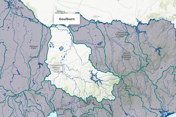
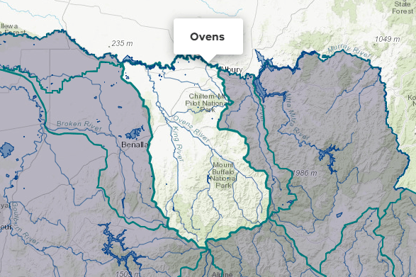
The Broken basin is in northern Victoria. It contains 2 connected stream networks, that of the Broken River in the southern half and the Broken Creek in the north. The Broken River flows into the Goulburn River at Shepparton, whereas the Broken Creek flows into the Murray River at Barmah. For the purpose of these Accounts, the Lower Broken Creek is reported in the Murray basin.
Rainfall reliability across the basin varies, with the highest levels observed in elevated areas like the Tolmie Highlands, and the lowest on the plains.
Most of the basin has been cleared for agriculture that supports grazing in the south, and mixed cereal and livestock farming in the central region.
A significant portion of the northern sector of the basin falls within the Goulburn-Murray Irrigation District (GMID), supporting fruit cultivation, dairying, and livestock production through irrigation. For water accounting purposes, the Broken basin excludes the GMID, which is instead incorporated into the Murray and Goulburn basins.
More information on water management and accounting is detailed in Water explained.
2024-25 overview
Available water
Catchment inflow was lower than the previous year.
Licensed diversion restrictions
There were more restrictions on licensed diversions than the previous year.
Seasonal determinations
Entitlements received 100% high- and low-reliability allocations, the same as the previous year.
Water use
A similar amount of water was diverted for consumptive purposes to the previous year.
When compared to the previous year, in 2024-25:
- less rainfall was received, catchment inflow was lower, and storage levels ended lower
- there were more restrictions on licensed diversions from streams
- seasonal allocations were the same, with both high- and low-reliability entitlements reaching 100% allocation 2 months later than during 2023-24
- a similar amount of water was diverted from the basin for consumptive use
- less water was diverted for environmental use.
Climate
Rainfall
In 2024-25, rainfall received in the Broken basin was lower than the previous year. Rainfall was:
- very much below average in the basin’s north-west around Shepparton, Katandra West and Dookie
- below average along the basin’s north-western tip and eastern half.
Figure 1 displays the rainfall received in 2024-25 compared to the long-term average (1975-2025).
Figure 1: Rainfall deciles, Broken basin
Sourced from the Australian Bureau of Meteorology
River basin water balance
This section describes the known and estimated inflows, outflows and change of storage volumes in the basin.
More detail on major on-stream storages, catchment inflows, diversions and small catchment dams can be found in the sections below the water balance.
Of the total inflows, 68% flowed out at the bottom of the basin in 2024-25.
Water balance table
The table below shows the total volumes of water available and supplied from water resources in the Broken basin in 2024-25.
Table 1: Water balance, Broken basin
Major on-stream storages
Major - greater than 1,000 ML - on-stream storages in the Broken basin are included in the water balance.
Storage levels
Storage levels were 45% in June 2025.
Lower than the previous year
In June 2024, storage levels were 79% full.
Table 2: Storage levels, Broken basin
Inflows
Catchment inflow
Catchment inflow represents the volume of water flowing into the waterways of a basin. It is calculated as the total outflows and change in storage minus the known inflows.
Below average inflows of 48,312 ML were received (19% of the long-term average of 255,200 ML), much less than the previous year (90% of the long-term average).
Below average inflow
Catchment inflow was 19% of the long-term average annual volume of 255,200 ML.
Less water received than the previous year
Catchment inflow was less than the previous year (90% of the long-term average).
Wastewater treatment plants
Water treated at wastewater treatment plants can be used to supplement water available in the basin. Water discharged to waterways from treatment plants is included as an inflow to the water balance.
Information on treatment plants is reported in the water supply local reports for the water corporation responsible for managing the plant.
In this basin, wastewater treatment plants are managed by North East Water.
Outflows
Diversions
In 2024-25, 13,025 ML of water was diverted from the waterway for town, domestic and stock, irrigation, commercial and environmental use, similar to the previous year (12,892 ML). While urban diversions were similar to the previous year, there was more water diverted for irrigation (licensed diversions) and less diverted for environmental use. There was also a 1,893 ML decrease in the estimate of small catchment dam use volume.
Small catchment dams
Water harvested, used and lost by small catchment dams (farm dams) is included in the water balance.
Table 3: Small catchment dams, Broken basin
Entitlements and compliance
Entitlements provide the basis for how water is shared in the basin.
Entitlements to water in the regulated part of the Broken basin provide for the right to carry over unused allocation to the next season. These entitlement holders can carry over unused water up to 50% of their high-reliability entitlement volume.
Consumptive diversions under bulk entitlements in the Broken basin are assessed against the Murray-Darling Basin annual cap target for the Goulburn-Broken-Loddon valley. Details of this assessment are published annually in the MDBA’s cap register and annual water take report.
Since 2019-20, the consumptive diversions are also assessed against the annual permitted takes under the Murray-Darling Basin Plan Sustainable Diversion Limit (SDL) compliance reporting which are annually published in the MDBA’s SDL accounts register of take and the Inspector-General of Water Compliance’s SDL compliance statement.
Entitlement volumes
Rights to water in the Broken basin are shown in Table 4.
Entitlement volumes represent an indication of a maximum volume of water that can be taken or allocated in any one year depending on the rules of the entitlement. The volume available in a particular year is dependent on the rules for allocating water set out in the entitlement, the seasonal conditions in that year and how much water was carried over from the previous year, which can vary. The rules for allocating water under an entitlement differ between entitlements and systems. This affects the ability and likelihood of water being taken in a particular year.
Table 4: Annual entitlement volumes at 30 June, Broken basin
Available water and take under entitlements
Total water available under entitlements represents the volume of water that was available to be taken by entitlement holders in 2024-25. The volume includes carryover from the previous year, seasonal allocations and net trade into the basin.
Water available under entitlements
Entitlements received 100% high- and low-reliability allocations, the same as the previous year.
Water taken under entitlements
There was 13,469 ML taken under entitlements in 2024-25, more than the previous year (11,312 ML).
Seasonal allocations
- High-reliability entitlement allocations opened at 5% and reached 100% in December 2024 (2 months later than the previous year).
- Low-reliability entitlement allocations opened at 0% and reached 100% in December 2024 (2 months later than the previous year).
Restrictions on licensed diversions from streams
- There was a peak of 4 streams with bans on licensed diversions from March to May 2025, with diversions from Boosey Creek banned for the entirety of 2024-25.
- During the previous year, there was a single ban in place on diversions from Boosey Creek for the entirety of the year.
Available water and take table
This table shows the volume of available water and the volume taken under entitlements in 2024-25. Water taken under entitlements could be used for a variety of uses.
More information on available water and take has been detailed in How we account for surface
In 2024-25, more water was taken under entitlements than the previous year.
Table 5: Available water and take under entitlements, Broken basin
Compliance
Compliance against water entitlements is reported for this basin in 3 areas:
- entitlement issued: that the volume of entitlements issued in a basin does not exceed formal caps, and has not increased without appropriate approvals
- water taken: that the volume of water taken during the year does not exceed the volume considered to be available for consumptive and/or in-stream use during that year
- bulk entitlement provisions: that holders of entitlements did not breach any provisions that are documented in their bulk entitlement orders.
Key points on compliance against entitlements in 2024-25
Total entitlement volume
There was an allowed net increase in the total entitlement volume from the previous year (4 ML). See note below.
Total volume diverted
The total volume diverted under entitlements (13,469 ML) was within the volume available for the year (33,270 ML).
Individual bulk entitlements
No individual bulk entitlement holder took more than the annual volume made available to them.
Exceptions to compliance
Individual bulk entitlement holders complied with all provisions in their entitlements except one. See note below.
Note to increase in total entitlement volume:
- During 2024-25, a 68 ML take and use licence (TUL) was subdivided and issued as a 20 ML licensed small catchment dams (SCD) entitlement and a 48 ML TUL. A TUL for 6 ML that was cancelled prior to 2024-25 was also transferred across to a licensed SCD entitlement. An additional TUL for 2 ML was surrendered by a customer during the year. This resulted in a net decrease of 22 ML in TULs and a net increase in SCDs of 26 ML.
Note to exceptions to compliance:
- Goulburn-Murray Water (GMW) reported a compliance failure, noting that during regulated conditions, the losses in Broken Creek were more than the 1,850 ML allowed loss by 407 ML. GMW also experienced a compliance difficulty with flows downstream of Nillahcootie being below the minimum requirement on one day by less than 1 ML. This was due to unanticipated minimum flow increases from higher inflows following localised rain.
Water for the environment
Environmental watering sites
Environmental watering sites and environmental values in the Broken basin that depend on water for the environment include:
- the Broken River, Upper Broken Creek and wetlands, which contain native fish habitat and a wetland of national significance
- Murray cod, trout cod and significant areas of intact riparian and floodplain vegetation.
Water from the Broken basin also flows into the Goulburn and Murray basins, helping to maintain internationally significant environmental assets in those basins.
Environmental water reserve
In 2024-25, water for the environment in the Broken basin comprised:
- water set aside for the environment through the operation of passing flows conditions:
- on consumptive bulk entitlements held by North East Water and Goulburn-Murray Water
- on licensed diversions
- 624 ML of high-reliability water shares and 23 ML of low-reliability water shares held for the environment
- all other water in the basin not allocated for consumptive uses: this water also provides social, recreational and cultural benefits.
Environmental water use
In 2024-25, 3,197 ML was delivered in the Broken basin. Of this, 1,711 ML was delivered in-stream and 1,486 ML was diverted off-stream. The diversion was made up of deliveries to Upper Broken Creek. These deliveries are reported as off-stream diversions, as the amount is typically lost via evaporation and seepage along Upper Broken Creek. There is no way to effectively measure throughflow to Lower Broken Creek.
Management responsibilities
Management of water in the Broken basin is undertaken by various parties
| Authority | Management responsibilities |
|---|---|
| Goulburn Broken Catchment Management Authority |
|
| Goulburn-Murray Water |
|
| Goulburn Valley Water |
|
| North East Water |
|
| Water supply system | 2023-24 (ML) | 2024-25 (ML) |
|---|---|---|
| Benalla | 1,582 | 1783 |