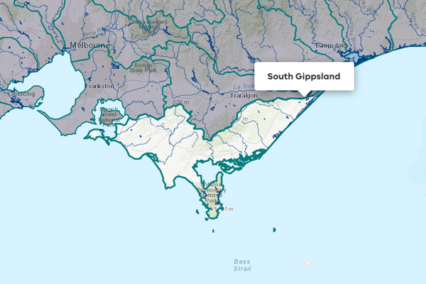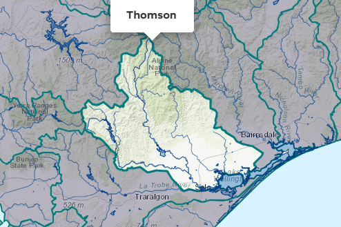
About the area
The Latrobe River flows in an easterly direction within a basin bound by the Strzelecki Ranges in the south and the Great Dividing Range in the north, before flowing into the Gippsland Lakes.
Annual rainfall in the north of the basin is over 1200 mm and reduces to 600-900 mm for much of the length of the river.
Water in the Latrobe basin is used for industry including power generation, urban use and agriculture.
More information on water management and accounting is detailed in Water explained.
2024-25 overview
Available water
Catchment inflow was lower than the previous year.
Licensed diversion restrictions
There were more restrictions on licensed diversions than the previous year.
Water use
A similar amount of water was diverted for consumptive purposes to the previous year.
When compared to the previous year, in 2024-25:
- less rainfall and catchment inflow was received, and storage levels ended the year lower
- there were more restrictions on licensed diversion from streams
- a similar amount of water was diverted from the basin for consumptive uses.
Climate
Rainfall
In 2024-25, rainfall in the Latrobe basin was lower than the previous year. Compared to the long-term average (1975-2025), rainfall was:
- the lowest on record south-west of Morwell around Thorpdale and Yinnar
- very much below average over most of the basin’s western and south-western regions
- below average in a band that spanned the north-west of the basin to southwards of Traralgon and near Longford
- average along parts of the basin’s north-east boundary, encompassing Baw Baw Village and areas east of Longford.
Figure 1 displays the rainfall received in 2024-25 compared to the long-term average.
Figure 1: Rainfall deciles, Latrobe basin
Sourced from the Australian Bureau of Meteorology
River basin water balance
This section describes the known and estimated inflows, outflows and change of storage volumes in the basin.
More detail on major on-stream storages, catchment inflows, diversions and small catchment dams can be found in the sections below the water balance.
Of the total inflows, 85% flowed out into the Gippsland Lakes in 2024-25.
Water balance table
The table below shows the total volumes of water available and supplied from water resources in the Latrobe basin in 2024-25.
Table 1: Water balance, Latrobe basin
Major on-stream storages
Major - greater than 1,000 ML - on-stream storages in the Latrobe basin are included in the water balance.
Storage levels
Major on-stream storage levels in the Latrobe basin were 69% on 30 June 2025.
Lower than the previous year
Storage levels were 98% on 30 June 2024.
Table 2: Storage levels, Latrobe basin
Inflows
Catchment inflow
Catchment inflow represents the volume of water flowing into the waterways of a basin. It is calculated as the total outflows and change in storage minus the known inflows.
Below average inflows of 550,676 ML were received (65% of the long-term average of 845,200 ML), less than the previous year (115% of the long-term average).
Below average inflow
Catchment inflow was 65% of the long-term average of 845,200 ML.
Less water received than the previous year
Catchment inflow was lower than the previous year (115% of the long-term average).
Wastewater treatment plants
Water treated at wastewater treatment plants can be used to supplement water available in the basin. Water discharged to waterways from treatment plants is included as an inflow to the water balance.
Information on treatment plants is reported in the water supply local reports for the water corporation responsible for managing the plant.
In this basin, wastewater treatment plants are managed by Gippsland Water.
Outflows
Diversions
In 2024-25, 132,976 ML of water was diverted for consumptive uses: town, domestic and stock, power generation, irrigation and commercial supply, similar to the 132,226 ML diverted in the previous year.
Small catchment dams
Water harvested, used and lost by small catchment dams (farm dams) is included in the water balance.
Table 3: Small catchment dams, Latrobe basin
Entitlements and compliance
Entitlements provide the basis for how water is shared in the basin.
Entitlement volumes
Rights to water in the Latrobe basin are shown in Table 4.
Entitlement volumes represent an indication of a maximum volume of water that can be taken or allocated in any one year depending on the rules of the entitlement. The volume available in a particular year is dependent on the rules for allocating water set out in the entitlement, the seasonal conditions in that year and how much water was carried over from the previous year, which can vary. The rules for allocating water under an entitlement differ between entitlements and systems. This affects the ability and likelihood of water being taken in a particular year.
Table 4: Annual entitlement volumes at 30 June, Latrobe basin
Available water and take under entitlements
Total water available under entitlements represents the volume of water that was available to be taken by entitlement holders in 2024-25. The volume includes carryover from the previous year, seasonal allocations and net trade into the basin.
Water taken
There was 151,329 ML taken under entitlements in 2024-25, more than the previous year (127,172 ML).
Restrictions on licensed diversions from streams
- There were bans or restrictions on licensed diversions from the Middle, Narracan, and Ten Mile Creeks, and from Whites Weir during 2024-25, compared to no restrictions on licensed diversions during the previous year.
- All other streams were unrestricted during the year.
Available water and take table
This table shows the volume of available water and the volume taken under entitlements in 2024-25.
More information on available water and take has been detailed in How we account for surface
In 2024-25, more water was taken under entitlements than the previous year.
Table 5: Available water and take under entitlements, Latrobe basin
Compliance
Compliance against water entitlements is reported for this basin in 3 areas:
- entitlement issued: that the volume of entitlements issued in a basin does not exceed formal caps, and has not increased without appropriate approvals
- water taken: that the volume of water taken during the year does not exceed the volume considered to be available for consumptive and/or in-stream use during that year
- bulk entitlement provisions: that holders of entitlements do not breach any provisions that are documented in their bulk entitlement orders.
Key points on compliance against entitlements in 2024-25
Total entitlement volume
There was no net increase in the total entitlement volume from the previous year.
Total volume diverted
The total volume diverted under entitlements (151,329 ML) was within the volume available for the year (269,259 ML).
Individual bulk entitlements
No individual bulk entitlement holder took more than the annual volume made available to them.
Exceptions to compliance
Individual bulk entitlement holders complied with all provisions in their entitlements.
Water for the environment
Environmental watering sites
Environmental watering sites and environmental values in the Latrobe basin that depend on water for the environment include:
- the Latrobe River, which contains native estuarine and freshwater fish species including black bream, Australian bass and short- and long-finned eel as well as platypus, freshwater turtles and continuous stands of river red gums in its upper reaches. The banks along the lower reaches support stands of swamp scrub, an endangered vegetation group.
- the lower Latrobe wetlands (including Sale Common, Dowd Morass and Heart Morass, which are part of the internationally recognised Gippsland Lakes Ramsar site). The lower Latrobe wetlands provide habitat for a variety of waterbirds. Mature river red gums also grow adjacent to the wetlands and provide nesting habitat for sea eagles and other birds of prey that hunt in the wetlands.
- the Gippsland Lakes, which are listed as internationally significant wetlands under the Ramsar Convention and partially rely on freshwater inputs from the Latrobe basin to function ecologically.
Environmental water reserve
In 2024-25, water for the environment in the Latrobe basin comprised:
- the Lower Latrobe Wetlands Environmental Entitlement 2010, held by the Victorian Environmental Water Holder (VEWH), which allows water to be diverted to Dowd Morass, Sale Common and Heart Morass when river levels are above heights specified in the environmental entitlement
- the Blue Rock Environmental Entitlement 2013, held by the VEWH, which provides a 9.45% share of inflows into Blue Rock Reservoir
- the Latrobe System Environmental Entitlement 2025, held by the VEWH, which provides 2.34% share of inflows into Blue Rock Reservoir and a 3.33% share of unregulated Latrobe River flows into, and downstream of, Lake Narracan, with a maximum annual take of 5,333 ML
- water set aside for the environment through the operation of passing flow conditions:
- on consumptive bulk entitlements held by Southern Rural Water and Gippsland Water
- on licensed diversions
- all other water in the basin not allocated for consumptive uses: this water also provides social, recreational and cultural benefits.
Environmental water use
In 2024-25, no environmental water was delivered in-stream in the Latrobe basin due to the channel constraints in the lower reaches (floodplain areas) of the Latrobe River. Environmental water was delivered to the lower Latrobe wetlands; however, this was not measured as per rules under the Lower Latrobe Wetlands Environmental Entitlement 2010 (see table 5).
Management responsibilities
Management of water in the Latrobe basin is undertaken by various parties
| Authority | Management responsibilities |
|---|---|
| Gippsland Water |
|
| Southern Rural Water |
|
| West Gippsland Catchment Management Authority |
|
| Water supply system | 2023-24 (ML) | 2024-25 (ML) |
|---|---|---|
| Erica / Rawson | 75 | 76 |
| Mirboo North | 174 | 208 |
| Moe System | 4,146 | 4,502 |
| Moondarra System | 48,678 | 43,309 |
| Willow Grove | 45 | 71 |
| Latrobe - Loy Yang B (entitlement) | 11,423 | 15,383 |
| Latrobe - Loy Yang A (entitlement) | 25,017 | 24,162 |
| Latrobe - Yallourn (entitlement) | 24,692 | 26,926 |